Fayl:Azerbaijan location map.svg
Naviqasiyaya keçin
Axtarışa keçin

Bu SVG-faylın PNG formatındakı bu görünüşünün ölçüsü: 512 × 392 piksel. Digər ölçülər: 314 × 240 piksel | 627 × 480 piksel | 1.003 × 768 piksel | 1.280 × 980 piksel | 2.560 × 1.960 piksel.
Faylın orijinalı (SVG faylı, nominal olaraq 512 × 392 piksel, faylın ölçüsü: 156 KB)
| Bu fayl "Vikimedia Commons"dadır və digər layihələrdə istifadə edilə bilər. |
 |
Faylın təsvir səhifəsinə get |
Xülasə
| İzah |
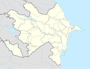
English: Location map of Azerbaijan. Borders of 1994-2020
Equirectangular projection. Strechted by 131.0%. Geographic limits of the map: * N: 42.0° N * S: 38.2° N * W: 44.5° E * E: 51.0° EMade with Natural Earth. Free vector and raster map data @ naturalearthdata.com. |
| Tarix | |
| Mənbə | Öz işi |
| Müəllif | Uwe Dedering, Don-kun |
| Digər versiyalar |
|


Lisenziya
I, the copyright holder of this work, hereby publish it under the following licenses:
Bu fayl Creative Commons Attribution-Share Alike 3.0 Unported lisenziyası altında yayımlanır.
- Azadsınız:
- paylaşmaq – əsəri köçürmək, paylamaq və ötürmək üçün
- remiks etmək – əsəri adaptasiya etmək
- Aşağıdakı şərtlərə riayət etməklə:
- istinad – Müvafiq kredit verməlisiniz, lisenziyaya bir keçid verməlisiniz və dəyişikliklərin olub olmadığını bildirməlisiniz. Bunu hər hansı bir ağlabatan şəkildə edə bilərsiniz, ancaq lisenziyalaşdırıcının sizi və ya istifadənizi təsdiqləməsini təklif edən bir şəkildə deyil.
- bənzər paylaşma – Əsəri remix edirsinizsə, dəyişdirirsinizsə və ya üzərində iş aparırsınızsa, öz töhfələrinizi orijinalda olduğu kimi eyni və ya uyğun lisenziya altında yayımlamalısınız.

|
Bu sənədi GNU Azad Sənədləşdirmə Lisenziyası, Versiya 1.2 və ya Azad Proqram Fondu tərəfindən nəşr olunan hər hansı sonrakı versiya şərtlərinə əsasən dəyişməz bölmələr, ön qapaq mətnləri və arxa qapaq mətnləri olmadan köçürmək, yayımlamaq və / və ya dəyişdirmək üçün icazə verilir; Lisenziyanın bir nüsxəsi GNU Azad Sənədləşdirmə Lisenziyası adlı hissəyə daxil edilmişdir. |
İstədiyiniz lisenziyanı seçə bilərsiniz.
Faylın tarixçəsi
Faylın əvvəlki versiyasını görmək üçün gün/tarix bölməsindəki tarixlərə klikləyin.
| Tarix/Vaxt | Kiçik şəkil | Ölçülər | İstifadəçi | Şərh | |
|---|---|---|---|---|---|
| indiki | 16:48, 10 yanvar 2024 | | 512 × 392 (156 KB) | Janitoalevic | Economic Regions |
| 08:09, 5 may 2016 |  | 1.200 × 919 (227 KB) | Rs4815 | Reverted to version as of 16:20, 21 April 2016 (UTC) | |
| 22:22, 3 may 2016 |  | 1.200 × 919 (217 KB) | Taron Saharyan | нет достоверных данных, вы переместили границу на 1 км. чуть ли не по всей линии, это бред | |
| 16:20, 21 aprel 2016 |  | 1.200 × 919 (227 KB) | Don-kun | fix karabakh border | |
| 09:46, 17 aprel 2016 |  | 1.200 × 919 (227 KB) | Don-kun | fix border to karabakh | |
| 16:46, 13 aprel 2016 |  | 1.200 × 919 (217 KB) | Don-kun | Jojug Marjanli now to Azerbaijan (region seemed to be a bit wrong before ...) and tried to fix some other parts of NKR-AZ-Border | |
| 19:43, 7 iyun 2010 |  | 1.200 × 919 (217 KB) | Don-kun | correct borders of rayons; hole area under karabakh control, not the former Nagorno-Karabakh Autonomous Oblast | |
| 13:11, 19 fevral 2010 |  | 1.200 × 919 (244 KB) | Uwe Dedering | Nagorno-Karabakh not grey, but visible | |
| 17:58, 18 fevral 2010 |  | 1.200 × 919 (244 KB) | Uwe Dedering | but really with dagestan | |
| 17:42, 18 fevral 2010 |  | 1.200 × 919 (233 KB) | Uwe Dedering | Dagestan and parts of Armenia saved from drowning, Nagorno-Karabakh now under the region-borders. |
Fayl keçidləri
Bu faylı istifadə edən səhifə yoxdur.
Faylın qlobal istifadəsi
Bu fayl aşağıdakı vikilərdə istifadə olunur:
- bn.wikipedia.org layihəsində istifadəsi
- ckb.wikipedia.org layihəsində istifadəsi
- de.wikipedia.org layihəsində istifadəsi
- fy.wikipedia.org layihəsində istifadəsi
- he.wikipedia.org layihəsində istifadəsi