Fayl:Baku on Jenkinson map.jpg
Faylın orijinalı (1.172 × 714 piksel, fayl həcmi: 193 KB, MIME növü: image/jpeg)
| Bu fayl "Vikimedia Commons"dadır və digər layihələrdə istifadə edilə bilər. |
 |
Faylın təsvir səhifəsinə get |
| İzah |
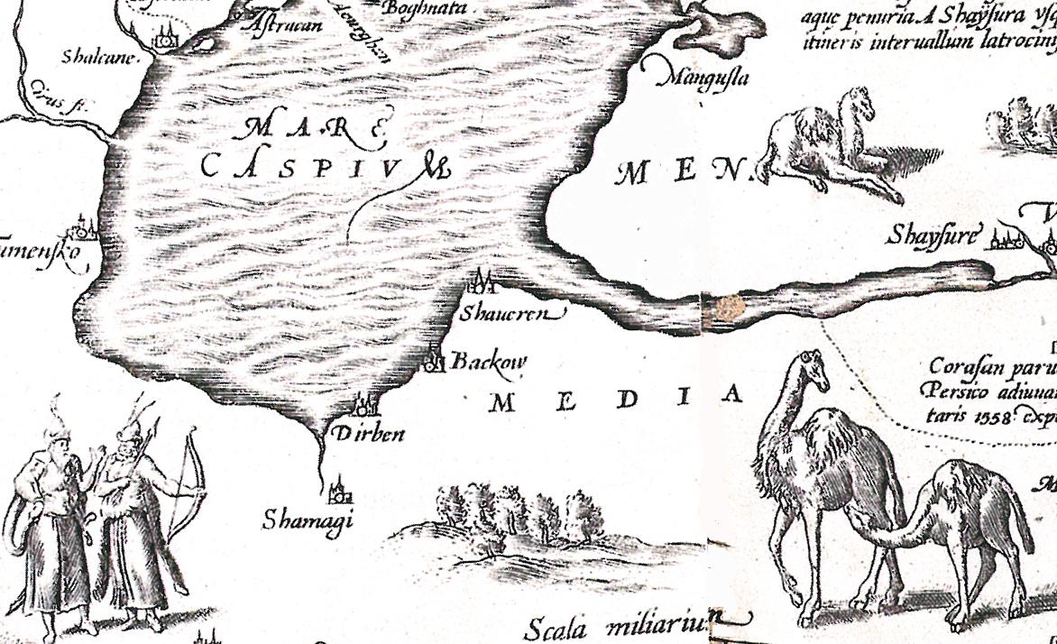
Русский: Россия Московия Тартария. Англо-голландская карта 1562 года (Лондон) с исправлениями 1598 года (Антверпен). Побережье Каспийского моря с указанием Дербента (Dirben), Шемахи (Shemagi) и Баку (Bakhow) |
| Tarix | və 1598 |
| Mənbə | Атлас "Украина на старинных картах", своё сканирование |
| Müəllif | Антоний Дженкинсон |
| Digər versiyalar | see also ruwiki |
|
This work is in the public domain in its country of origin and other countries and areas where the copyright term is the author's life plus 70 years or fewer.
| |
| This file has been identified as being free of known restrictions under copyright law, including all related and neighboring rights. | |
Faylın tarixçəsi
Faylın əvvəlki versiyasını görmək üçün gün/tarix bölməsindəki tarixlərə klikləyin.
| Tarix/Vaxt | Kiçik şəkil | Ölçülər | İstifadəçi | Şərh | |
|---|---|---|---|---|---|
| indiki | 07:35, 15 iyun 2010 | | 1.172 × 714 (193 KB) | Interfase | cleaning |
| 06:58, 15 iyun 2010 |  | 1.172 × 714 (737 KB) | Interfase | {{Information |Description={{ru|1=Россия Московия Тартария. Англо-голландская карта 1562 года (Лондон) с исправлениями 1598 года (Антверпен). Побережье Каспийс |
Fayl keçidləri
Aşağıdakı 2 səhifə bu faylı istifadə edir:
Faylın qlobal istifadəsi
Bu fayl aşağıdakı vikilərdə istifadə olunur:
- azb.wikipedia.org layihəsində istifadəsi
- ru.wikipedia.org layihəsində istifadəsi