Fayl:Locator map Saarland in Germany.svg
Naviqasiyaya keçin
Axtarışa keçin

Bu SVG-faylın PNG formatındakı bu görünüşünün ölçüsü: 443 × 599 piksel. Digər ölçülər: 177 × 240 piksel | 355 × 480 piksel | 567 × 768 piksel | 757 × 1.024 piksel | 1.513 × 2.048 piksel | 592 × 801 piksel.
Faylın orijinalı (SVG faylı, nominal olaraq 592 × 801 piksel, faylın ölçüsü: 668 KB)
| Bu fayl "Vikimedia Commons"dadır və digər layihələrdə istifadə edilə bilər. |
 |
Faylın təsvir səhifəsinə get |
Xülasə
.svg)
.svg)
.svg)
.svg)
.svg)
.svg)
.svg)

-en.svg)

.svg)
.svg)
.svg)

_(US48).svg)
_(small_islands_magnified)_(-mini_map_-rivers).svg)
.svg)
_(extra_close)_(US48).svg)
.svg)
_(zoom).svg)

.svg)


_(UNMIK).svg)
.svg)
_(disputed_hatched).svg)
_(claimed_and_disputed_hatched).svg)
.svg)
.svg)
_(%2Ball_claims_hatched).svg)

.svg)
_(shade).svg)
_(shade)_(special_marker).svg)
_(-mini_map).svg)
_(-mini_map).svg)
_(-mini_map).svg)


.svg)

.svg)
Lisenziya
I, the copyright holder of this work, hereby publish it under the following licenses:

|
Bu sənədi GNU Azad Sənədləşdirmə Lisenziyası, Versiya 1.2 və ya Azad Proqram Fondu tərəfindən nəşr olunan hər hansı sonrakı versiya şərtlərinə əsasən dəyişməz bölmələr, ön qapaq mətnləri və arxa qapaq mətnləri olmadan köçürmək, yayımlamaq və / və ya dəyişdirmək üçün icazə verilir; Lisenziyanın bir nüsxəsi GNU Azad Sənədləşdirmə Lisenziyası adlı hissəyə daxil edilmişdir. |
This file is licensed under the Creative Commons Attribution-Share Alike 3.0 Unported, 2.5 Generic, 2.0 Generic and 1.0 Generic license.
- Azadsınız:
- paylaşmaq – əsəri köçürmək, paylamaq və ötürmək üçün
- remiks etmək – əsəri adaptasiya etmək
- Aşağıdakı şərtlərə riayət etməklə:
- istinad – Müvafiq kredit verməlisiniz, lisenziyaya bir keçid verməlisiniz və dəyişikliklərin olub olmadığını bildirməlisiniz. Bunu hər hansı bir ağlabatan şəkildə edə bilərsiniz, ancaq lisenziyalaşdırıcının sizi və ya istifadənizi təsdiqləməsini təklif edən bir şəkildə deyil.
- bənzər paylaşma – Əsəri remix edirsinizsə, dəyişdirirsinizsə və ya üzərində iş aparırsınızsa, öz töhfələrinizi orijinalda olduğu kimi eyni və ya uyğun lisenziya altında yayımlamalısınız.
İstədiyiniz lisenziyanı seçə bilərsiniz.
Faylın tarixçəsi
Faylın əvvəlki versiyasını görmək üçün gün/tarix bölməsindəki tarixlərə klikləyin.
| Tarix/Vaxt | Kiçik şəkil | Ölçülər | İstifadəçi | Şərh | |
|---|---|---|---|---|---|
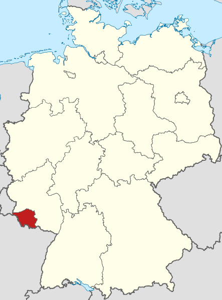
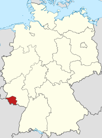
| indiki | 18:02, 11 mart 2009 | | 592 × 801 (668 KB) | TUBS | =={{int:filedesc}}== {{Information |Description= {{de|Lage von Saarland in Deutschland}} {{en|Locator map of Saarland in Germany.}} |Source= {{de|Eigene Arbeit}} {{en|Own work}} |Date=2 |
Fayl keçidləri
Aşağıdakı 2 səhifə bu faylı istifadə edir:
Faylın qlobal istifadəsi
Bu fayl aşağıdakı vikilərdə istifadə olunur:
- af.wikipedia.org layihəsində istifadəsi
- ar.wikipedia.org layihəsində istifadəsi
- arz.wikipedia.org layihəsində istifadəsi
- ast.wikipedia.org layihəsində istifadəsi
- ay.wikipedia.org layihəsində istifadəsi
- be.wikipedia.org layihəsində istifadəsi
- bs.wikipedia.org layihəsində istifadəsi
- ca.wikipedia.org layihəsində istifadəsi
- ceb.wikipedia.org layihəsində istifadəsi
- crh.wikipedia.org layihəsində istifadəsi
- cs.wikipedia.org layihəsində istifadəsi
- de.wikipedia.org layihəsində istifadəsi
- Saarland
- Ökologisch-Demokratische Partei
- Liste der Ministerpräsidenten der deutschen Länder
- Piratenpartei Deutschland
- Liste von Schulen der Sekundarstufe I im Saarland
- Christlich Demokratische Union Deutschlands
- Wikipedia:Landtagsprojekt/Saarland/Interesse
- Wikipedia:Landtagsprojekt/Saarland
- Wikipedia:Landtagsprojekt/Saarland/Ergebnisse
- Wikipedia:Landtagsprojekt/Saarland/Blog
- Wikipedia:Landtagsprojekt/Saarland/Aktueller Stand
- Wikipedia:Landtagsprojekt/Saarland/Titelleiste Kurz
- Wikipedia:Landtagsprojekt/Saarland/FAQ
- V-Partei³
- Liste der Landtagspräsidenten der deutschen Länder
- de.wikivoyage.org layihəsində istifadəsi
- diq.wikipedia.org layihəsində istifadəsi
- el.wikipedia.org layihəsində istifadəsi
- eml.wikipedia.org layihəsində istifadəsi
- en.wikipedia.org layihəsində istifadəsi
- en.wiktionary.org layihəsində istifadəsi
- es.wikipedia.org layihəsində istifadəsi
- et.wikipedia.org layihəsində istifadəsi
- fi.wiktionary.org layihəsində istifadəsi
- frr.wikipedia.org layihəsində istifadəsi
- fr.wikinews.org layihəsində istifadəsi
- ga.wikipedia.org layihəsində istifadəsi
- gl.wikipedia.org layihəsində istifadəsi
- hsb.wikipedia.org layihəsində istifadəsi
- hy.wikipedia.org layihəsində istifadəsi
- ia.wikipedia.org layihəsində istifadəsi
Bu faylın qlobal istifadəsinə baxın.