Fayl:Southern Ocean.png
Naviqasiyaya keçin
Axtarışa keçin
Daha yüksək versiyası yoxdur.
Southern_Ocean.png (330 × 330 piksel, fayl həcmi: 10 KB, MIME növü: image/png)
| Bu fayl "Vikimedia Commons"dadır və digər layihələrdə istifadə edilə bilər. |
 |
Faylın təsvir səhifəsinə get |

|
This locator map image could be re-created using vector graphics as an SVG file. This has several advantages; see Commons:Media for cleanup for more information. If an SVG form of this image is available, please upload it and afterwards replace this template with
{{vector version available|new image name}}.
It is recommended to name the SVG file “Southern Ocean.svg”—then the template Vector version available (or Vva) does not need the new image name parameter. |
Xülasə
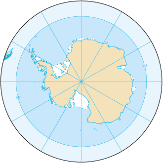
Southern_Ocean (from en:) Map from CIA Factbook 2003: Southern Ocean archive copy at the Wayback Machine (picture link is [1]).
![[1]](https://www.cia.gov/library/publications/the-world-factbook/maps/oo-map.gif)
English version: File:Southern Ocean - en.png Slovene version: File:Southern Ocean-sl.png
Lisenziya
This image is in the public domain because it contains materials that originally came from the United States Central Intelligence Agency's World Factbook.
|
 |
Faylın tarixçəsi
Faylın əvvəlki versiyasını görmək üçün gün/tarix bölməsindəki tarixlərə klikləyin.
| Tarix/Vaxt | Kiçik şəkil | Ölçülər | İstifadəçi | Şərh | |
|---|---|---|---|---|---|
| indiki | 20:16, 22 avqust 2009 | | 330 × 330 (10 KB) | Serg!o | language neutral map |
| 11:52, 3 noyabr 2004 |  | 330 × 330 (10 KB) | Maximaximax | Southern_Ocean (from en:) Map from [http://www.cia.gov/cia/publications/factbook/geos/oo.html CIA Factbook 2003: Southern Ocean] (picture link is [http://www.cia.gov/cia/publications/factbook/maps/oo-map.gif]). |
Fayl keçidləri
Aşağıdakı səhifə bu faylı istifadə edir:
Faylın qlobal istifadəsi
Bu fayl aşağıdakı vikilərdə istifadə olunur:
- af.wikipedia.org layihəsində istifadəsi
- an.wikipedia.org layihəsində istifadəsi
- arc.wikipedia.org layihəsində istifadəsi
- ar.wikipedia.org layihəsində istifadəsi
- as.wikipedia.org layihəsində istifadəsi
- azb.wikipedia.org layihəsində istifadəsi
- bat-smg.wikipedia.org layihəsində istifadəsi
- ba.wikipedia.org layihəsində istifadəsi
- be-tarask.wikipedia.org layihəsində istifadəsi
- be.wikipedia.org layihəsində istifadəsi
- bjn.wikipedia.org layihəsində istifadəsi
- bs.wikipedia.org layihəsində istifadəsi
- bxr.wikipedia.org layihəsində istifadəsi
- ca.wikipedia.org layihəsində istifadəsi
- cs.wikipedia.org layihəsində istifadəsi
- cv.wikipedia.org layihəsində istifadəsi
- da.wikipedia.org layihəsində istifadəsi
- da.wiktionary.org layihəsində istifadəsi
- el.wikipedia.org layihəsində istifadəsi
- en.wikipedia.org layihəsində istifadəsi
- en.wikibooks.org layihəsində istifadəsi
- en.wikiversity.org layihəsində istifadəsi
- en.wiktionary.org layihəsində istifadəsi
- eo.wikipedia.org layihəsində istifadəsi
Bu faylın qlobal istifadəsinə baxın.