Fayl:Tanzania location map.svg

Vikipediya, azad ensiklopediya
Naviqasiyaya keçin Axtarışa keçin

Faylın orijinalı(SVG faylı, nominal olaraq 3.302 × 3.143 piksel, faylın ölçüsü: 1,04 MB)

Bu fayl "Vikimedia Commons"dadır
və digər layihələrdə istifadə edilə bilər.
təsvir səhifəsi
təsvir səhifəsi
Faylın təsvir səhifəsinə get

Xülasə

İzah
Afrikaans: Liggingkaart van Tanzanië
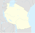
English: Location map of Tanzania
Español: Mapa de georreferenciación de Tanzania
Français : Carte de géolocalisation de la Tanzanie
Equirectangular projection. 0.25° N, 28° W, 42° E, -13° S. Center : -6.375 35
Tarix (UTC)
Mənbə
Müəllif
Digər versiyalar

Derivative works of this file:  Iringa Regionen.png [redaktə]

İstinad
(required by the license)
InfoField
© Sémhur / Wikimedia Commons / 
© Sémhur / Wikimedia Commons
SVG
InfoField
 
W3C-validity not checked.
 
This W3C-unspecified vector image was created with Inkscape…important .
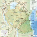
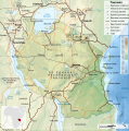
Bu təsvirin redaktəsi, orijinala əsaslanaraq rəqəmsal qaydadadır. Dəyişiklik: Cropped, and prepared for geolocation.. İlkin təsvir buradadır: Tanzania map-fr.svg. Redaktə etdi Sémhur.

Graphic Lab
InfoField
Object location6° 22′ 30″ S, 35° 00′ 00″ E  Heading=1° Kartographer map based on OpenStreetMap.View this and other nearby images on: OpenStreetMapinfo

Lisenziya

I, the copyright holder of this work, hereby publish it under the following licenses:
w:az:Creative Commons
istinad bənzər paylaşma
This file is licensed under the Creative Commons Attribution-Share Alike 4.0 International, 3.0 Unported, 2.5 Generic, 2.0 Generic and 1.0 Generic license.
Azadsınız:
  • paylaşmaq – əsəri köçürmək, paylamaq və ötürmək üçün
  • remiks etmək – əsəri adaptasiya etmək
Aşağıdakı şərtlərə riayət etməklə:
  • istinad – Müvafiq kredit verməlisiniz, lisenziyaya bir keçid verməlisiniz və dəyişikliklərin olub olmadığını bildirməlisiniz. Bunu hər hansı bir ağlabatan şəkildə edə bilərsiniz, ancaq lisenziyalaşdırıcının sizi və ya istifadənizi təsdiqləməsini təklif edən bir şəkildə deyil.
  • bənzər paylaşma – Əsəri remix edirsinizsə, dəyişdirirsinizsə və ya üzərində iş aparırsınızsa, öz töhfələrinizi orijinalda olduğu kimi eyni və ya uyğun lisenziya altında yayımlamalısınız.
Licence Art Libre Copyleft: This work of art is free; you can redistribute it and/or modify it according to terms of the Free Art License. You will find a specimen of this license on the Copyleft Attitude site as well as on other sites.
İstədiyiniz lisenziyanı seçə bilərsiniz.

Orijinal yükləmə gündəliyi

This image is a derivative work of the following images:

  • File:Tanzania_map-fr.svg licensed with Cc-by-sa-3.0,2.5,2.0,1.0, GFDL
    • 2009-03-20T13:30:18Z Sémhur 3096x3113 (3225659 Bytes) Ol Doinyo Lengaï was misplaced
    • 2009-03-20T11:14:35Z Sémhur 3096x3113 (3224368 Bytes) Add location map and few summits.
    • 2009-03-19T17:14:13Z Sémhur 3096x3113 (3099209 Bytes) grrr...
    • 2009-03-19T17:08:18Z Sémhur 3096x3113 (3099244 Bytes) Oups ! It wasn't the valid one.
    • 2009-03-19T17:05:02Z Sémhur 3096x3113 (3122421 Bytes) {{Information |Description={{en|1=Map of [[:en:Tanzania]].}} {{fr|1=Carte de la [[:fr:Tanzanie]].}} {{es|1=Mapa de [[:es:Tanzania]].}} |Source=travail personnel (own work). Sources of data: * Elevations : NASA SRTM3 (public d

Uploaded with derivativeFX

Orijinal yükləmə gündəliyi

date/time username resolution size edit summary
2009-05-03T08:48:31Z User:Sémhur 3096×2947 828.71Kb borders above waters
2009-05-03T08:45:18Z User:Sémhur 3096×2947 828.72Kb Adding border between Arusha and Manyara
2009-05-01T18:46:42Z User:Sémhur 3096×2947 822.6Kb {{int:summary}} {{Information |Description={{en|1=Location map of [[:en:Tanzania]].}} {{fr|1=Carte de géolocalisation de la [[:fr:Tanzanie]].}} {{es|1=Mapa de georreferenciación de [[:es:Tanzania]].}} Equirectangular projection. 0.25° N, 28° W, 42°

Captions

Add a one-line explanation of what this file represents
Location map of Tanzania

Items portrayed in this file

təsvir edir

copyrighted ingilis

1 may 2009

6°S, 35°E

heading ingilis: 1 dərəcə

MIME type ingilis

image/svg+xml

Faylın tarixçəsi

Faylın əvvəlki versiyasını görmək üçün gün/tarix bölməsindəki tarixlərə klikləyin.

Tarix/VaxtKiçik şəkilÖlçülərİstifadəçiŞərh
indiki20:15, 25 may 201720:15, 25 may 2017 tarixindəki versiyanın kiçildilmiş görüntüsü3.302 × 3.143 (1,04 MB)SémhurUpdated with Songwe Region
14:16, 13 dekabr 201314:16, 13 dekabr 2013 tarixindəki versiyanın kiçildilmiş görüntüsü3.096 × 2.947 (1,03 MB)SémhurUpdated with the four new regions
00:30, 25 iyul 200900:30, 25 iyul 2009 tarixindəki versiyanın kiçildilmiş görüntüsü3.096 × 2.947 (829 KB)BetacommandBotmove approved by: User:Sémhur This image was moved from File:Tanzania location equirectangular map.svg =={{int:summary}}== {{Information |Description={{en|1=Location map of en:Tanzania.}} {{fr|1=Carte de géolocalisation de la [[:fr:Tanz

Faylın qlobal istifadəsi

Metaməlumatlar