Fayl:90mile beach nz landsatimage.jpg
Naviqasiyaya keçin
Axtarışa keçin

Sınaq göstərişi ölçüsü: 800 × 593 piksel. Digər ölçülər: 320 × 237 piksel | 640 × 474 piksel | 1.024 × 758 piksel | 1.280 × 948 piksel.
Faylın orijinalı (1.280 × 948 piksel, fayl həcmi: 101 KB, MIME növü: image/jpeg)
| Bu fayl "Vikimedia Commons"dadır və digər layihələrdə istifadə edilə bilər. |
 |
Faylın təsvir səhifəsinə get |
Xülasə
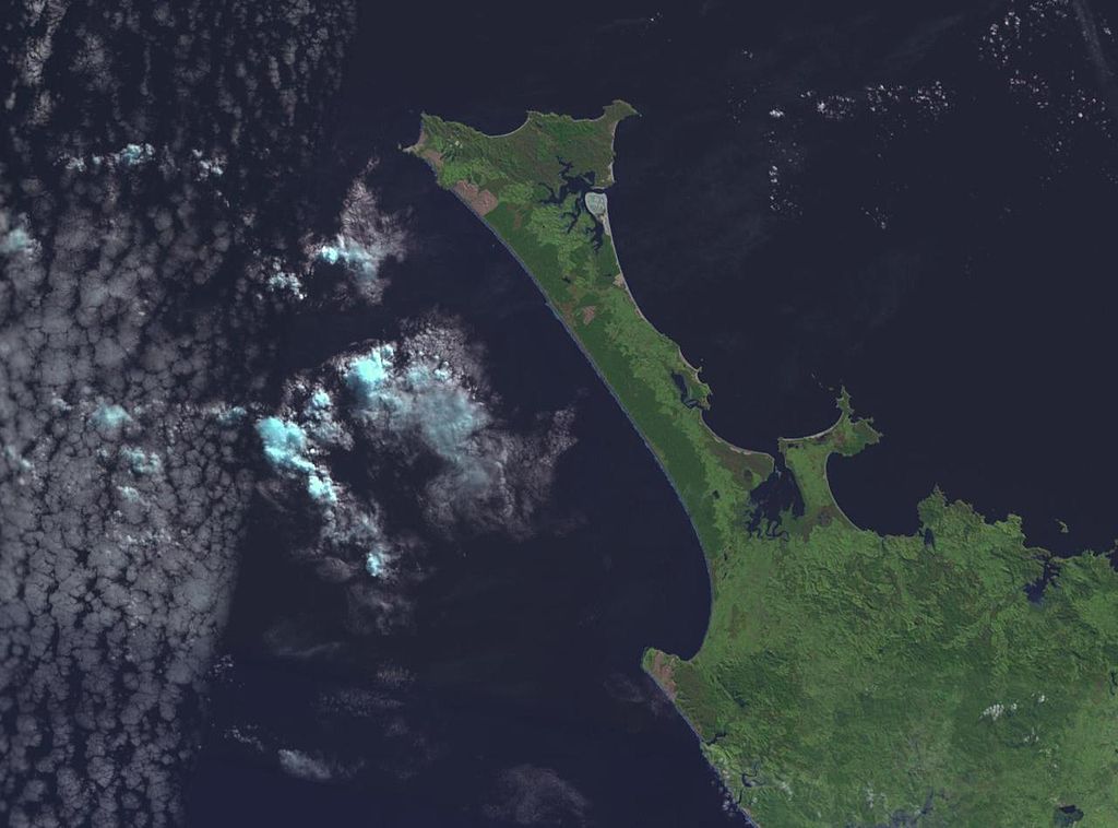
NASA World wind image of Aupouri Peninsula in New Zealand. Ninety Mile Beach, New Zealand is on the west (left) side of the peninsula.

Lisenziya
| This image is in the public domain because it is a screenshot from NASA’s globe software World Wind using a public domain layer, such as Blue Marble, MODIS, Landsat, SRTM, USGS or GLOBE.
|
 |
derivative works
Derivative works of this file: 90mile beach nz landsatimage crop.jpg
Faylın tarixçəsi
Faylın əvvəlki versiyasını görmək üçün gün/tarix bölməsindəki tarixlərə klikləyin.
| Tarix/Vaxt | Kiçik şəkil | Ölçülər | İstifadəçi | Şərh | |
|---|---|---|---|---|---|
| indiki | 18:52, 1 sentyabr 2005 | | 1.280 × 948 (101 KB) | Klipp~commonswiki | NASA World wind image of Aupouri Peninsula in New Zealand. Ninety Mile Beach, New Zealand is on the west (left) side of the peninsula. |
Fayl keçidləri
Aşağıdakı səhifə bu faylı istifadə edir:
Faylın qlobal istifadəsi
Bu fayl aşağıdakı vikilərdə istifadə olunur:
- bn.wikipedia.org layihəsində istifadəsi
- ceb.wikipedia.org layihəsində istifadəsi
- cy.wikipedia.org layihəsində istifadəsi
- de.wikipedia.org layihəsində istifadəsi
- de.wikivoyage.org layihəsində istifadəsi
- en.wikipedia.org layihəsində istifadəsi
- en.wikivoyage.org layihəsində istifadəsi
- es.wikipedia.org layihəsində istifadəsi
- fr.wikipedia.org layihəsində istifadəsi
- he.wikipedia.org layihəsində istifadəsi
- id.wikipedia.org layihəsində istifadəsi
- it.wikipedia.org layihəsində istifadəsi
- ko.wikipedia.org layihəsində istifadəsi
- nn.wikipedia.org layihəsində istifadəsi
- no.wikipedia.org layihəsində istifadəsi
- pl.wikipedia.org layihəsində istifadəsi
- pt.wikipedia.org layihəsində istifadəsi
- ru.wikipedia.org layihəsində istifadəsi
- sv.wikipedia.org layihəsində istifadəsi
- www.wikidata.org layihəsində istifadəsi