Fayl:Khanate of Karabakh in 1809-1817.JPG

Faylın orijinalı (662 × 616 piksel, fayl həcmi: 80 KB, MIME növü: image/jpeg)
| Bu fayl "Vikimedia Commons"dadır və digər layihələrdə istifadə edilə bilər. |
 |
Faylın təsvir səhifəsinə get |
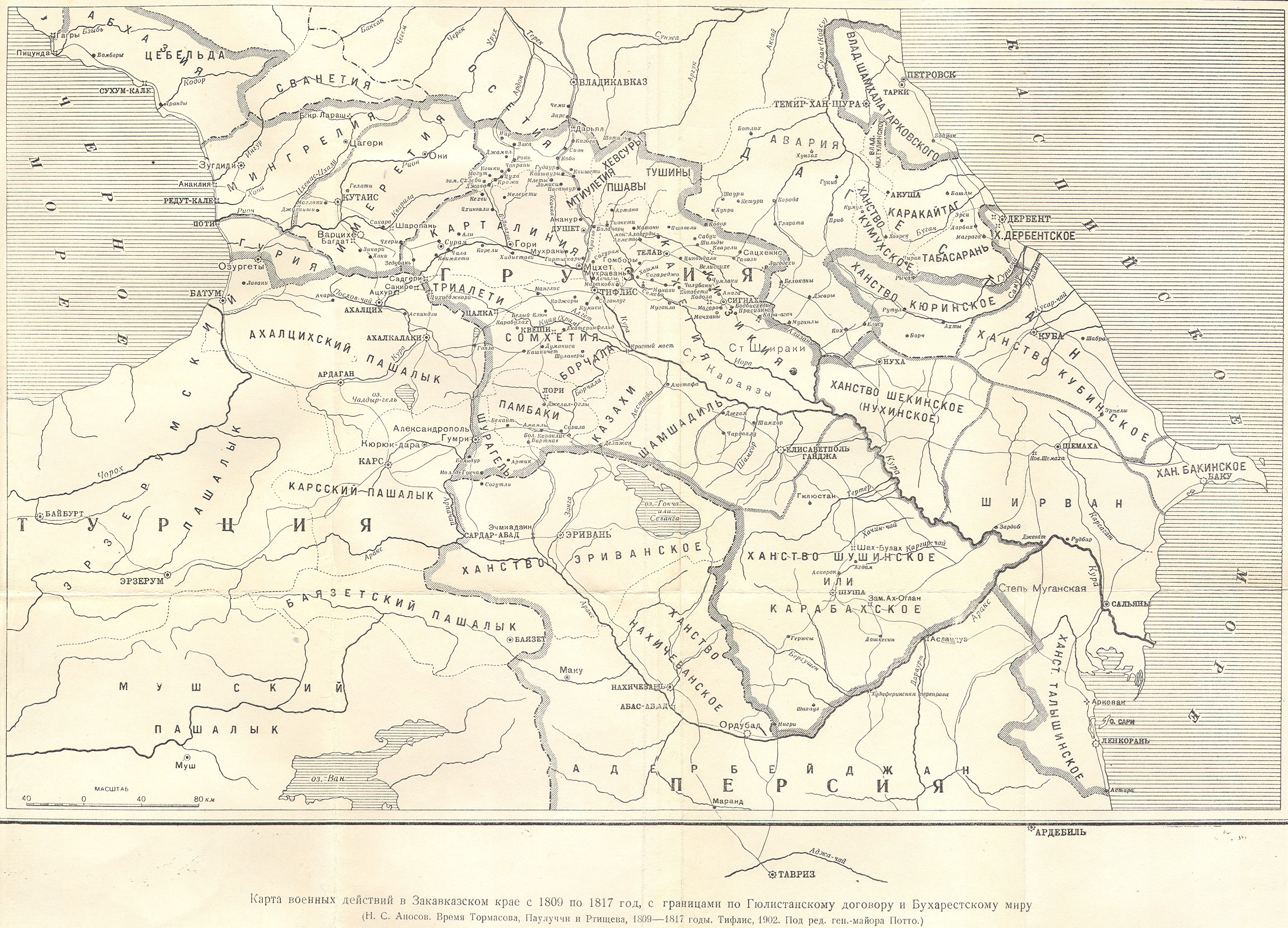
| İzah | Azerbaijani khanate of Karabakh in the map of Caucasus in 1809-1817 years (Карта военных действий в Закавказском крае с 1809 по 1817 год) | ||||
| Tarix | 1902, Тифлис | ||||
| Mənbə |
|
||||
| Müəllif | под редакцией ген.-майора Потто. Postwork by Interfase | ||||
| İcazə (Faylın təkrar istifadəsi) |
|
||||
Faylın tarixçəsi
Faylın əvvəlki versiyasını görmək üçün gün/tarix bölməsindəki tarixlərə klikləyin.
| Tarix/Vaxt | Kiçik şəkil | Ölçülər | İstifadəçi | Şərh | |
|---|---|---|---|---|---|
| indiki | 07:30, 24 iyun 2010 | | 662 × 616 (80 KB) | Interfase | {{Information |Description=Azerbaijani khanate of Karabakh in the map of Caucasus in 1809-1817 years (Карта военных действий в Закавказском крае с 1809 по 1817 год) |Source=http://www.runivers.ru/images/date/2009 |
Fayl keçidləri
Faylın qlobal istifadəsi
Bu fayl aşağıdakı vikilərdə istifadə olunur:
- azb.wikipedia.org layihəsində istifadəsi
- az.wiktionary.org layihəsində istifadəsi
- be.wikipedia.org layihəsində istifadəsi
- bn.wikipedia.org layihəsində istifadəsi
- cv.wikipedia.org layihəsində istifadəsi
- eo.wikipedia.org layihəsində istifadəsi
- et.wikipedia.org layihəsində istifadəsi
- fa.wikipedia.org layihəsində istifadəsi
- fi.wikipedia.org layihəsində istifadəsi
- it.wikipedia.org layihəsində istifadəsi
- la.wikipedia.org layihəsində istifadəsi
- lt.wikipedia.org layihəsində istifadəsi
- ml.wikipedia.org layihəsində istifadəsi
- nl.wikipedia.org layihəsində istifadəsi
- pnb.wikipedia.org layihəsində istifadəsi
- pt.wikipedia.org layihəsində istifadəsi
- ru.wikipedia.org layihəsində istifadəsi
- sh.wikipedia.org layihəsində istifadəsi
- sr.wikipedia.org layihəsində istifadəsi
- tr.wikipedia.org layihəsində istifadəsi
- uk.wikipedia.org layihəsində istifadəsi
- ur.wikipedia.org layihəsində istifadəsi
- zh.wikipedia.org layihəsində istifadəsi