Fayl:Map of Alabama highlighting Cullman County.svg
Naviqasiyaya keçin
Axtarışa keçin

Bu SVG-faylın PNG formatındakı bu görünüşünün ölçüsü: 379 × 600 piksel. Digər ölçülər: 152 × 240 piksel | 303 × 480 piksel | 485 × 768 piksel | 647 × 1.024 piksel | 1.294 × 2.048 piksel | 3.379 × 5.346 piksel.
Faylın orijinalı (SVG faylı, nominal olaraq 3.379 × 5.346 piksel, faylın ölçüsü: 94 KB)
| Bu fayl "Vikimedia Commons"dadır və digər layihələrdə istifadə edilə bilər. |
 |
Faylın təsvir səhifəsinə get |
Xülasə
| İzah |
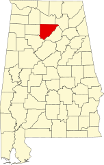
English: This is a locator map showing Cullman County in Alabama. For more information, see Commons:United States county locator maps. |
| Tarix | |
| Mənbə |
Öz işi: English: The maps use data from nationalatlas.gov, specifically countyp020.tar.gz on the Raw Data Download page. The maps also use state outline data from statesp020.tar.gz. The Florida maps use hydrogm020.tar.gz to display Lake Okeechobee. |
| Müəllif | David Benbennick |
Lisenziya
| This work has been released into the public domain by its author, David Benbennick. This applies worldwide. In some countries this may not be legally possible; if so: |
Faylın tarixçəsi
Faylın əvvəlki versiyasını görmək üçün gün/tarix bölməsindəki tarixlərə klikləyin.
| Tarix/Vaxt | Kiçik şəkil | Ölçülər | İstifadəçi | Şərh | |
|---|---|---|---|---|---|
| indiki | 09:51, 12 fevral 2006 | | 3.379 × 5.346 (94 KB) | David Benbennick | {{subst:User:Dbenbenn/clm|county=Cullman County|state=Alabama}} |
Fayl keçidləri
Aşağıdakı səhifə bu faylı istifadə edir:
Faylın qlobal istifadəsi
Bu fayl aşağıdakı vikilərdə istifadə olunur:
- ar.wikipedia.org layihəsində istifadəsi
- azb.wikipedia.org layihəsində istifadəsi
- bg.wikipedia.org layihəsində istifadəsi
- bpy.wikipedia.org layihəsində istifadəsi
- ca.wikipedia.org layihəsində istifadəsi
- Arab
- Baileyton
- Bremen (Alabama)
- Colony (Alabama)
- Cullman
- Dodge City (Alabama)
- Fairview (Alabama)
- Garden City (Alabama)
- Good Hope (Alabama)
- Hanceville
- Holly Pond
- South Vinemont
- West Point (Alabama)
- Llista de comtats d'Alabama
- Plantilla:Comtat de Cullman (Alabama)
- Categoria:Comtat de Cullman (Alabama)
- cdo.wikipedia.org layihəsində istifadəsi
- ceb.wikipedia.org layihəsində istifadəsi
- cs.wikipedia.org layihəsində istifadəsi
- cy.wikipedia.org layihəsində istifadəsi
- de.wikipedia.org layihəsində istifadəsi
- en.wikipedia.org layihəsində istifadəsi
- List of counties in Alabama
- Cullman County, Alabama
- Garden City, Alabama
- Arab, Alabama
- Baileyton, Alabama
- Colony, Alabama
- Cullman, Alabama
- Dodge City, Alabama
- Fairview, Alabama
- Good Hope, Alabama
- Hanceville, Alabama
- Holly Pond, Alabama
- South Vinemont, Alabama
- West Point, Alabama
- Bremen, Alabama
- Template:Cullman County, Alabama
Bu faylın qlobal istifadəsinə baxın.