Fayl:Map of USA HI full.png
Naviqasiyaya keçin
Axtarışa keçin
Daha yüksək versiyası yoxdur.
Map_of_USA_HI_full.png (286 × 186 piksel, fayl həcmi: 21 KB, MIME növü: image/png)
| Bu fayl "Vikimedia Commons"dadır və digər layihələrdə istifadə edilə bilər. |
 |
Faylın təsvir səhifəsinə get |
Xülasə

|
File:Map of USA HI full.svg is a vector version of this file. It should be used in place of this PNG file when not inferior.
File:Map of USA HI full.png → File:Map of USA HI full.svg
For more information, see Help:SVG. |
 |
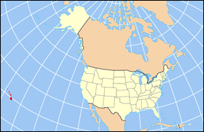
| İzah | Map of USA with Hawaii highlighted and shown in true position |
| Mənbə | http://www.nationalatlas.gov/printable/reference.html |
| Müəllif |
Lisenziya
This map was obtained from an edition of the National Atlas of the United States. Like almost all works of the U.S. federal government, works from the National Atlas are in the public domain in the United States.
Online access: NationalAtlas.gov | 1970 print edition: Library of Congress, Perry-Castañeda Library
|
Faylın tarixçəsi
Faylın əvvəlki versiyasını görmək üçün gün/tarix bölməsindəki tarixlərə klikləyin.
| Tarix/Vaxt | Kiçik şəkil | Ölçülər | İstifadəçi | Şərh | |
|---|---|---|---|---|---|
| indiki | 16:30, 2 aprel 2007 | | 286 × 186 (21 KB) | MattWright | fix to more standard map colors |
| 19:09, 1 aprel 2007 |  | 286 × 186 (19 KB) | MattWright | {{Information |Description=Map of USA with Hawaii highlighted and shown in true position |Source=http://www.nationalatlas.gov/printable/reference.html |Date= |Author= |Permission= |other_versions= }} Category:Maps of the United States [[Category:Maps |
Fayl keçidləri
Bu faylı istifadə edən səhifə yoxdur.
Faylın qlobal istifadəsi
Bu fayl aşağıdakı vikilərdə istifadə olunur:
- bcl.wikipedia.org layihəsində istifadəsi
- bo.wikipedia.org layihəsində istifadəsi
- da.wikipedia.org layihəsində istifadəsi
- en.wikipedia.org layihəsində istifadəsi
- es.wikipedia.org layihəsində istifadəsi
- fa.wikipedia.org layihəsində istifadəsi
- hu.wikipedia.org layihəsində istifadəsi
- id.wikipedia.org layihəsində istifadəsi
- ja.wikipedia.org layihəsində istifadəsi
- ko.wikipedia.org layihəsində istifadəsi
- mrj.wikipedia.org layihəsində istifadəsi
- mr.wikipedia.org layihəsində istifadəsi
- pl.wikipedia.org layihəsində istifadəsi
- pl.wikinews.org layihəsində istifadəsi
- pl.wiktionary.org layihəsində istifadəsi
- ro.wikipedia.org layihəsində istifadəsi
- sv.wikipedia.org layihəsində istifadəsi
- uk.wikipedia.org layihəsində istifadəsi
Bu faylın qlobal istifadəsinə baxın.