Fayl:Bosporus Strait and Istanbul, Turkey.jpeg
Naviqasiyaya keçin
Axtarışa keçin
Sınaq göstərişi ölçüsü: 600 × 600 piksel. Digər ölçülər: 240 × 240 piksel | 480 × 480 piksel | 768 × 768 piksel | 1.024 × 1.024 piksel | 2.048 × 2.048 piksel | 7.200 × 7.200 piksel.
Faylın orijinalı (7.200 × 7.200 piksel, fayl həcmi: 8,95 MB, MIME növü: image/jpeg)
| Bu fayl "Vikimedia Commons"dadır və digər layihələrdə istifadə edilə bilər. |
 |
Faylın təsvir səhifəsinə get |
Xülasə
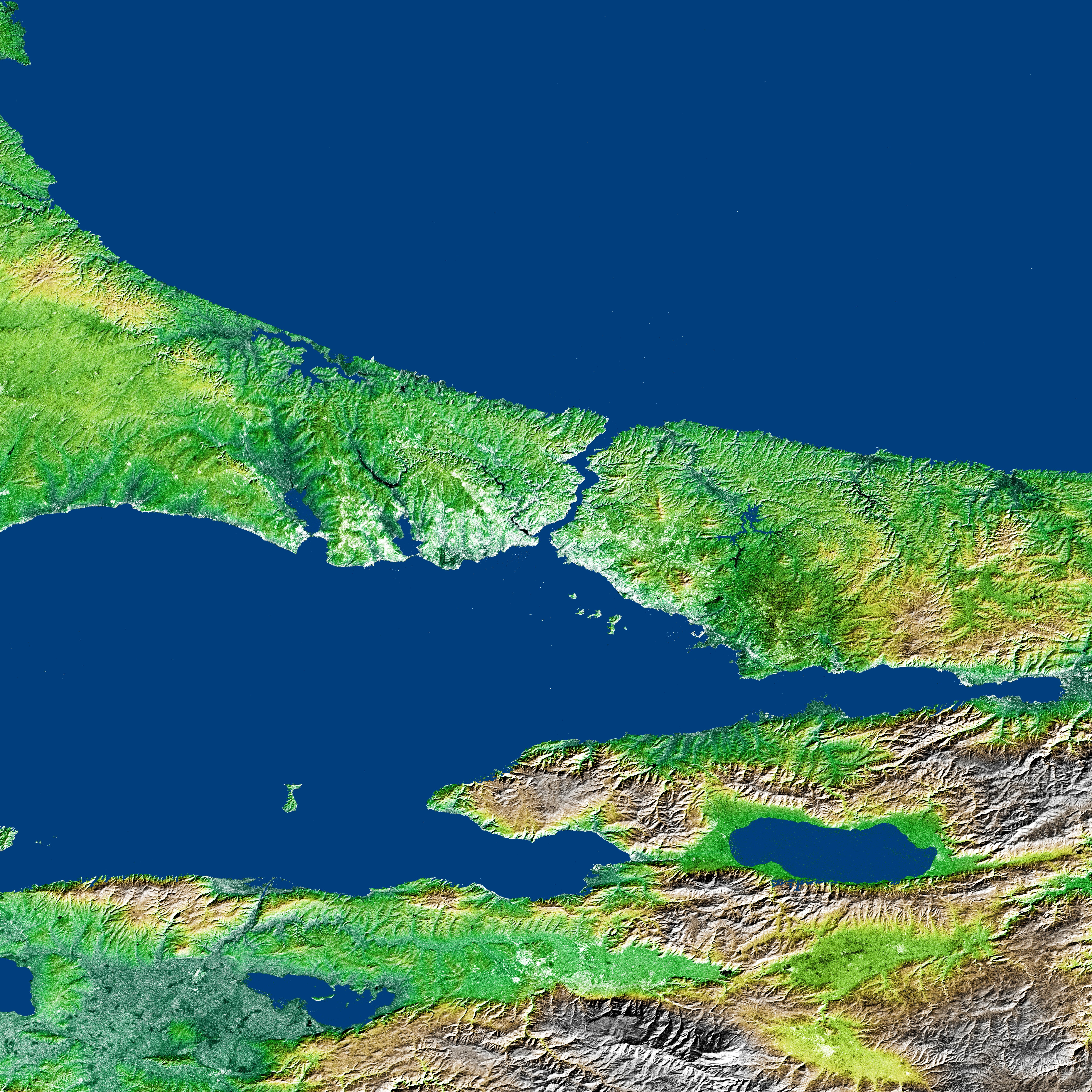
Shaded Relief and Radar Image with Color as Height, Bosporus Strait and Istanbul, Turkey.
- Source: http://photojournal.jpl.nasa.gov/catalog/PIA03349
- compare http://visibleearth.nasa.gov/view_rec.php?id=2624 archive copy at the Wayback Machine
- Visible Earth v1 ID 12596
- Visualization Date 2002-04-24
This image or video was catalogued by Jet Propulsion Laboratory of the United States National Aeronautics and Space Administration (NASA) under Photo ID: PIA03349. This tag does not indicate the copyright status of the attached work. A normal copyright tag is still required. See Commons:Licensing. Other languages:
|
Lisenziya
| This file is in the public domain in the United States because it was solely created by NASA. NASA copyright policy states that "NASA material is not protected by copyright unless noted". (See Template:PD-USGov, NASA copyright policy page or JPL Image Use Policy.) | ||
 |
Warnings:
|
This image uses high-resolution digital topography data from NASA's Shuttle Radar Topography Mission (SRTM) at JPL-Caltech [4]. It is in the public domain in the United States.
|
 | |
Faylın tarixçəsi
Faylın əvvəlki versiyasını görmək üçün gün/tarix bölməsindəki tarixlərə klikləyin.
| Tarix/Vaxt | Kiçik şəkil | Ölçülər | İstifadəçi | Şərh | |
|---|---|---|---|---|---|
| indiki | 00:10, 10 fevral 2005 | | 7.200 × 7.200 (8,95 MB) | Ævar Arnfjörð Bjarmason |
Fayl keçidləri
Aşağıdakı 2 səhifə bu faylı istifadə edir:
Faylın qlobal istifadəsi
Bu fayl aşağıdakı vikilərdə istifadə olunur:
- ang.wikipedia.org layihəsində istifadəsi
- ar.wikipedia.org layihəsində istifadəsi
- be-tarask.wikipedia.org layihəsində istifadəsi
- bg.wikipedia.org layihəsində istifadəsi
- ceb.wikipedia.org layihəsində istifadəsi
- en.wikipedia.org layihəsində istifadəsi
- et.wikipedia.org layihəsində istifadəsi
- fi.wikipedia.org layihəsində istifadəsi
- fr.wikipedia.org layihəsində istifadəsi
- hr.wikipedia.org layihəsində istifadəsi
- hy.wikipedia.org layihəsində istifadəsi
- ko.wikipedia.org layihəsində istifadəsi
- lmo.wikipedia.org layihəsində istifadəsi
- ltg.wikipedia.org layihəsində istifadəsi
- lt.wikipedia.org layihəsində istifadəsi
- nn.wikipedia.org layihəsində istifadəsi
- no.wikipedia.org layihəsində istifadəsi
- ru.wikipedia.org layihəsində istifadəsi
- sh.wikipedia.org layihəsində istifadəsi
- sv.wikipedia.org layihəsində istifadəsi
- tr.wikipedia.org layihəsində istifadəsi
- uk.wikipedia.org layihəsində istifadəsi
- vls.wikipedia.org layihəsində istifadəsi
- www.wikidata.org layihəsində istifadəsi