Fayl:C71188s5 Ant.Map Cape Adare.jpg
Naviqasiyaya keçin
Axtarışa keçin
Sınaq göstərişi ölçüsü: 557 × 599 piksel. Digər ölçülər: 223 × 240 piksel | 446 × 480 piksel | 714 × 768 piksel | 952 × 1.024 piksel | 1.903 × 2.048 piksel | 2.877 × 3.096 piksel.
Faylın orijinalı (2.877 × 3.096 piksel, fayl həcmi: 1,53 MB, MIME növü: image/jpeg)
| Bu fayl "Vikimedia Commons"dadır və digər layihələrdə istifadə edilə bilər. |
 |
Faylın təsvir səhifəsinə get |
Xülasə
| İzah |
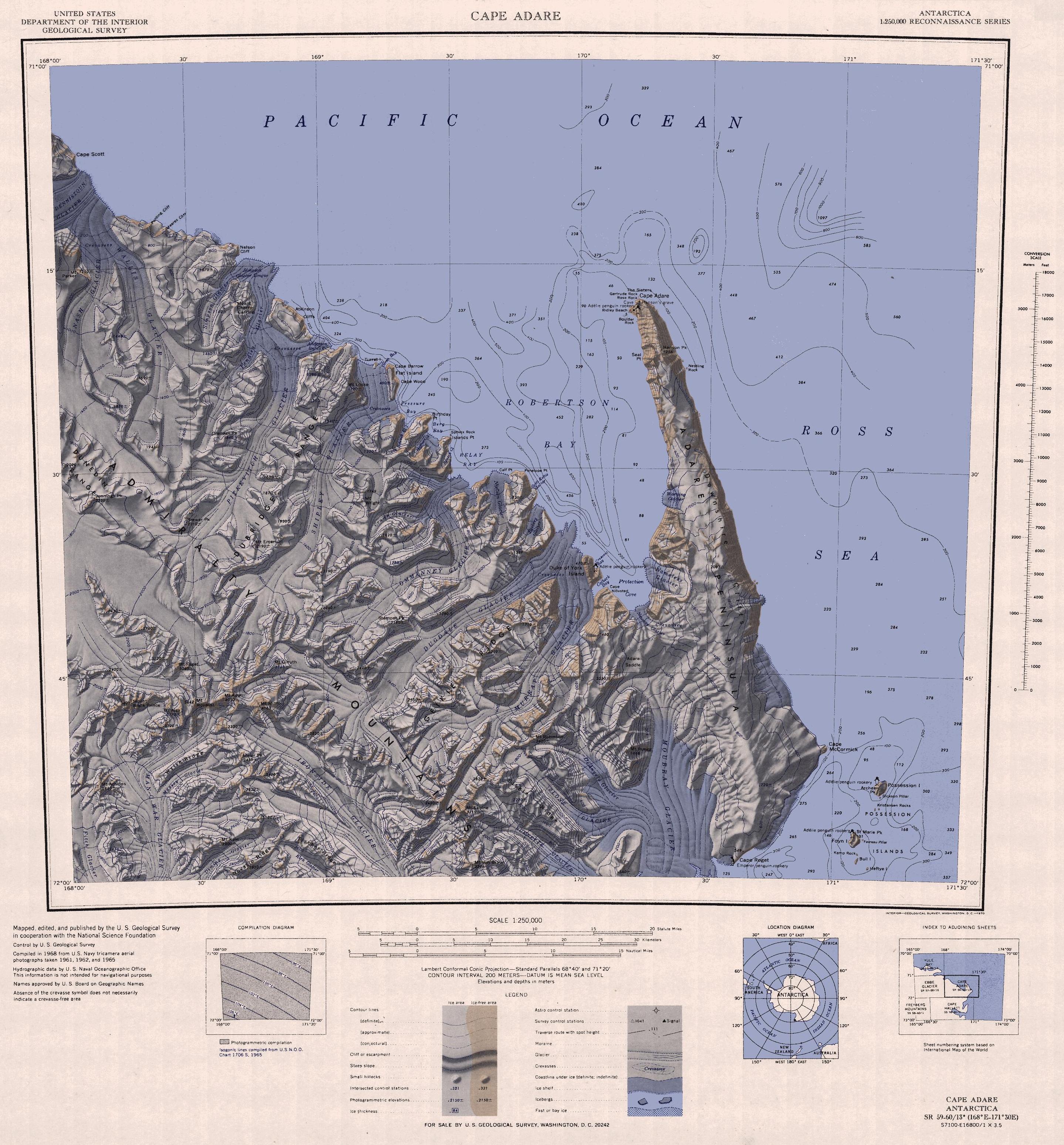
English: 1:250,000-scale topographic reconnaissance map of the Cape Adare region in Antarctica (168°E - 171°30'E, 71°S - 72°S). Mapped, edited and published by the U.S. Geological Survey in cooperation with the National Science Foundation. |
|||
| Tarix | ||||
| Mənbə | http://usarc.usgs.gov/drg_dload.shtml | |||
| Müəllif | United States Geological Survey | |||
| İcazə (Faylın təkrar istifadəsi) |
|
|||
| Digər versiyalar |
Derivative works of this file: |
Faylın tarixçəsi
Faylın əvvəlki versiyasını görmək üçün gün/tarix bölməsindəki tarixlərə klikləyin.
| Tarix/Vaxt | Kiçik şəkil | Ölçülər | İstifadəçi | Şərh | |
|---|---|---|---|---|---|
| indiki | 12:47, 26 noyabr 2015 | | 2.877 × 3.096 (1,53 MB) | ValeriySh | Обрізка зайвого поля |
| 16:43, 3 aprel 2005 |  | 3.506 × 3.260 (1,67 MB) | Achim Raschka | Map of Antarctica by the United States Antarctic Ressource Center of the US Geological Society. {{PD-US}} Copyrights and Trademarks USGS-authored or produced data and information are in the public domain. While the content of most USGS web pages is in th |
Fayl keçidləri
Aşağıdakı səhifə bu faylı istifadə edir:
Faylın qlobal istifadəsi
Bu fayl aşağıdakı vikilərdə istifadə olunur:
- ar.wikipedia.org layihəsində istifadəsi
- ast.wikipedia.org layihəsində istifadəsi
- be.wikipedia.org layihəsində istifadəsi
- bg.wikipedia.org layihəsində istifadəsi
- ceb.wikipedia.org layihəsində istifadəsi
- de.wikipedia.org layihəsində istifadəsi
- el.wikipedia.org layihəsində istifadəsi
- en.wikipedia.org layihəsində istifadəsi
- eo.wikipedia.org layihəsində istifadəsi
- es.wikipedia.org layihəsində istifadəsi
- fr.wikipedia.org layihəsində istifadəsi
- he.wikipedia.org layihəsində istifadəsi
- id.wikipedia.org layihəsində istifadəsi
- it.wikipedia.org layihəsində istifadəsi
Bu faylın qlobal istifadəsinə baxın.