Fayl:Fiji detail.jpg
Naviqasiyaya keçin
Axtarışa keçin

Sınaq göstərişi ölçüsü: 589 × 600 piksel. Digər ölçülər: 236 × 240 piksel | 600 × 611 piksel.
Faylın orijinalı (600 × 611 piksel, fayl həcmi: 50 KB, MIME növü: image/jpeg)
| Bu fayl "Vikimedia Commons"dadır və digər layihələrdə istifadə edilə bilər. |
 |
Faylın təsvir səhifəsinə get |

|
This map has been uploaded by Electionworld from en.wikipedia.org to enable the |
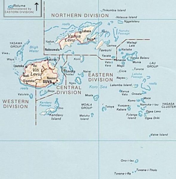
PNG map of Fiji from CIA World Factbook.
This image is in the public domain because it contains materials that originally came from the United States Central Intelligence Agency's World Factbook.
|
 |
Faylın tarixçəsi
Faylın əvvəlki versiyasını görmək üçün gün/tarix bölməsindəki tarixlərə klikləyin.
| Tarix/Vaxt | Kiçik şəkil | Ölçülər | İstifadəçi | Şərh | |
|---|---|---|---|---|---|
| indiki | 12:51, 30 iyun 2010 | | 600 × 611 (50 KB) | Telim tor | exchanged positions of Tuvana-i-Ra and Tuvana-i-Tholo (i-Ra is the southwestern one, see also [http://www.un.org/Depts/Cartographic/map/profile/Fiji.pdf this map] (PDF) |
| 19:45, 27 noyabr 2006 |  | 600 × 611 (48 KB) | Electionworld | {{ew|en|Pascal}} PNG map of Fiji from CIA World Factbook. {{PD-USGov-CIA-WF}} Category:Maps of Fiji |
Fayl keçidləri
Aşağıdakı 2 səhifə bu faylı istifadə edir:
Faylın qlobal istifadəsi
Bu fayl aşağıdakı vikilərdə istifadə olunur:
- avk.wikipedia.org layihəsində istifadəsi
- be.wikipedia.org layihəsində istifadəsi
- cs.wikipedia.org layihəsində istifadəsi
- de.wikipedia.org layihəsində istifadəsi
- en.wikipedia.org layihəsində istifadəsi
- es.wikinews.org layihəsində istifadəsi
- io.wikipedia.org layihəsində istifadəsi
- ka.wikipedia.org layihəsində istifadəsi
- pl.wikipedia.org layihəsində istifadəsi
- ru.wikipedia.org layihəsində istifadəsi
- tr.wikipedia.org layihəsində istifadəsi
- uk.wikipedia.org layihəsində istifadəsi
- www.wikidata.org layihəsində istifadəsi