Fayl:Gwadar satellite view.jpg
Naviqasiyaya keçin
Axtarışa keçin
Sınaq göstərişi ölçüsü: 600 × 600 piksel. Digər ölçülər: 240 × 240 piksel | 480 × 480 piksel | 768 × 768 piksel | 1.024 × 1.024 piksel | 2.000 × 2.000 piksel.
Faylın orijinalı (2.000 × 2.000 piksel, fayl həcmi: 636 KB, MIME növü: image/jpeg)
| Bu fayl "Vikimedia Commons"dadır və digər layihələrdə istifadə edilə bilər. |
 |
Faylın təsvir səhifəsinə get |
Xülasə
| İzah |
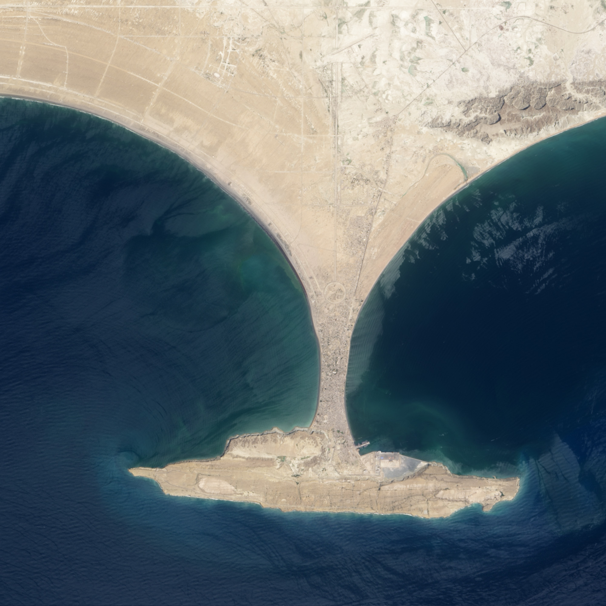
English: This image shows the area before Zalzala Jazeera (Earthquake Island) surfaced in the upper left quadrant of this image of Gwadar, Pakistan. File:Gwadar satellite view showing island created by 2013 earthquake.jpg shows the same view with the island. |
| Tarix | |
| Mənbə | http://earthobservatory.nasa.gov/NaturalHazards/view.php?id=82146 |
| Müəllif | NASA |
| Camera location | | View this and other nearby images on: OpenStreetMap |
|---|
Lisenziya
| This file is in the public domain in the United States because it was solely created by NASA. NASA copyright policy states that "NASA material is not protected by copyright unless noted". (See Template:PD-USGov, NASA copyright policy page or JPL Image Use Policy.) | ||
 |
Warnings:
|
Faylın tarixçəsi
Faylın əvvəlki versiyasını görmək üçün gün/tarix bölməsindəki tarixlərə klikləyin.
| Tarix/Vaxt | Kiçik şəkil | Ölçülər | İstifadəçi | Şərh | |
|---|---|---|---|---|---|
| indiki | 01:04, 28 sentyabr 2013 | | 2.000 × 2.000 (636 KB) | Ke4roh | User created page with UploadWizard |
Fayl keçidləri
Aşağıdakı səhifə bu faylı istifadə edir:
Faylın qlobal istifadəsi
Bu fayl aşağıdakı vikilərdə istifadə olunur:
- ceb.wikipedia.org layihəsində istifadəsi
- en.wikipedia.org layihəsində istifadəsi
- es.wikipedia.org layihəsində istifadəsi
- fr.wikipedia.org layihəsində istifadəsi
- it.wikipedia.org layihəsində istifadəsi
- nl.wikipedia.org layihəsində istifadəsi
- ru.wikipedia.org layihəsində istifadəsi
- sl.wikipedia.org layihəsində istifadəsi
- sv.wikipedia.org layihəsində istifadəsi
- tr.wikipedia.org layihəsində istifadəsi
- uk.wikipedia.org layihəsində istifadəsi
- www.wikidata.org layihəsində istifadəsi