Fayl:Ice Floes off the Northeastern Tip of Urup Island, Russia.jpg
Faylın orijinalı (4.288 × 2.848 piksel, fayl həcmi: 3,03 MB, MIME növü: image/jpeg)
| Bu fayl "Vikimedia Commons"dadır və digər layihələrdə istifadə edilə bilər. |
 |
Faylın təsvir səhifəsinə get |
Xülasə
| İzah |
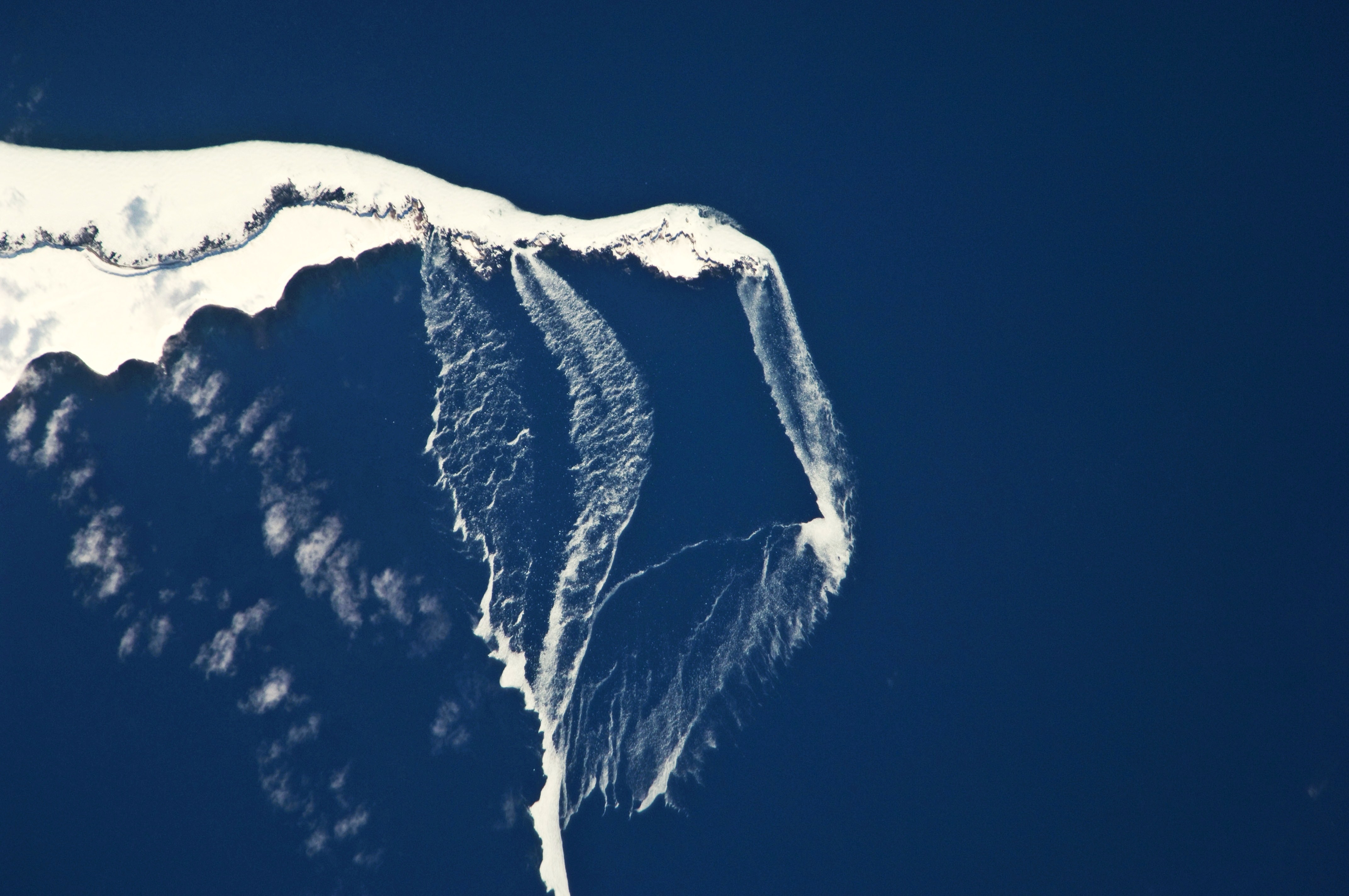
English: The north-eastern tip of the island and three small islands to the north-east are recognizable by their uniform cover of white snow and shadowing along the north-western coastlines. Sea ice that formed to the north in the Sea of Okhotsk has been piled up against the islands by prevailing north-westerly winds, forming an irregular mass connecting the islands (image centre). The orientation of patchy low clouds over Urup Island (image lower left) also suggests that north-westerly winds are present. Smaller ice floes are breaking off from the main ice mass at gaps between the islands and forming finger-like projections of ice fragments that extend to the south-east (image lower right). Surface winds may be channelled through these gaps and accelerated, hastening the breakup and movement of ice. |
| Tarix | |
| Mənbə | NASA Earth Observatory |
| Müəllif | Image captured by the NASA Expedition 23 crew |
Image acquired with a Nikon D2Xs digital camera fitted with an 800 mm lens, and is provided by the ISS Crew Earth Observations experiment and Image Science & Analysis Laboratory, Johnson Space Center. Center Point Latitude: 46.2 Center Point Longitude: 150.6 (Negative numbers indicate south for latitude and west for longitude). Camera Tilt: 13 Camera Focal Length: 800mm Camera: N2: Nikon D2Xs Film: 4288E : 4288 x 2848 pixel CMOS sensor, RGBG imager color filter. Nadir Point Latitude: 46.4, Longitude: 151.3 (Negative numbers indicate south for latitude and west for longitude) Nadir to Photo Center Direction: West Sun Azimuth: 127 (Clockwise angle in degrees from north to the sun measured at the nadir point) Spacecraft Altitude: 183 nautical miles (339 km) Sun Elevation Angle: 35 (Angle in degrees between the horizon and the sun, measured at the nadir point).
Lisenziya
| This file is in the public domain in the United States because it was solely created by NASA. NASA copyright policy states that "NASA material is not protected by copyright unless noted". (See Template:PD-USGov, NASA copyright policy page or JPL Image Use Policy.) | ||
 |
Warnings:
|
| Annotations | This image is annotated: View the annotations at Commons |
Faylın tarixçəsi
Faylın əvvəlki versiyasını görmək üçün gün/tarix bölməsindəki tarixlərə klikləyin.
| Tarix/Vaxt | Kiçik şəkil | Ölçülər | İstifadəçi | Şərh | |
|---|---|---|---|---|---|
| indiki | 12:36, 19 aprel 2010 | | 4.288 × 2.848 (3,03 MB) | Originalwana | {{Information |Description={{en|1=The north-eastern tip of the island and three small islands to the north-east are recognizable by their uniform cover of white snow and shadowing along the north-western coastlines. [[:C |
Fayl keçidləri
Aşağıdakı səhifə bu faylı istifadə edir:
Faylın qlobal istifadəsi
Bu fayl aşağıdakı vikilərdə istifadə olunur:
- bg.wikipedia.org layihəsində istifadəsi
- en.wikipedia.org layihəsində istifadəsi
- gl.wikipedia.org layihəsində istifadəsi
- it.wikipedia.org layihəsində istifadəsi
- ru.wikipedia.org layihəsində istifadəsi