Fayl:Lake Borgne de la Tour map 1720.jpg
Faylın orijinalı (1.158 × 966 piksel, fayl həcmi: 398 KB, MIME növü: image/jpeg)
| Bu fayl "Vikimedia Commons"dadır və digər layihələrdə istifadə edilə bilər. |
 |
Faylın təsvir səhifəsinə get |
Xülasə
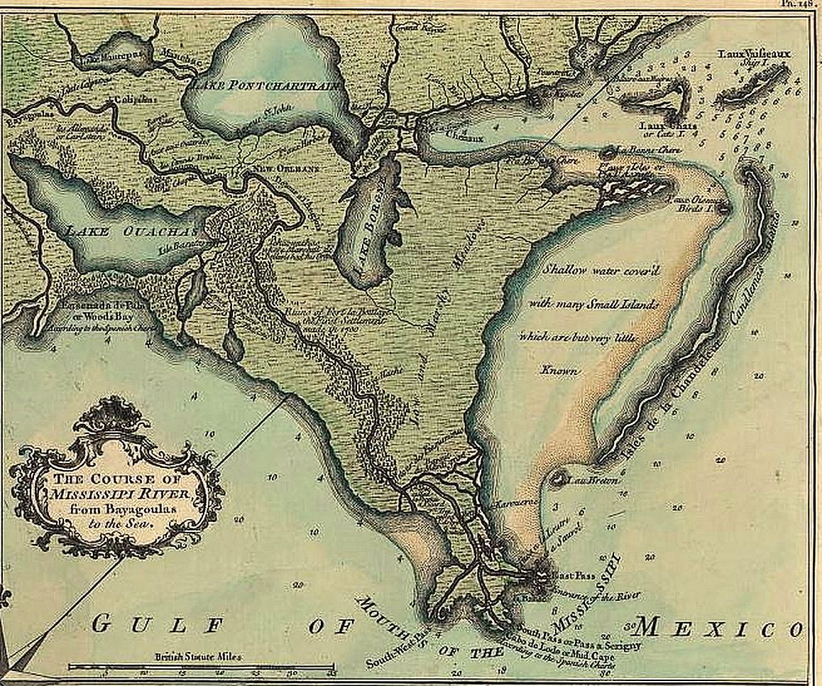
Detail of the map from the de la Tour survey of 1720 as published in 1759, showing the New Orleans area with Lake Borgne, Lake Pontchartrain Basin, and lower Missisissippi River.
Copyright expired.
Related Image: Image:New Orleans de la Tour map 1720 1759.jpg Full published version of De la Tour survey map
Lisenziya
|
This work is in the public domain in its country of origin and other countries and areas where the copyright term is the author's life plus 70 years or fewer.
| |
| This file has been identified as being free of known restrictions under copyright law, including all related and neighboring rights. | |
Faylın tarixçəsi
Faylın əvvəlki versiyasını görmək üçün gün/tarix bölməsindəki tarixlərə klikləyin.
| Tarix/Vaxt | Kiçik şəkil | Ölçülər | İstifadəçi | Şərh | |
|---|---|---|---|---|---|
| indiki | 06:25, 30 sentyabr 2014 | | 1.158 × 966 (398 KB) | Gwillhickers | larger image, better color tone and clarity |
| 16:34, 9 may 2006 |  | 656 × 547 (249 KB) | Infrogmation | Detail of the map from the de la Tour survey of 1720 as published in 1759, showing the New Orleans area with Lake Borgne, Lake Pontchartrain Basin, and lower Missisissippi River. Copyright expired. Category:Lake Pontchartrain [[Category:Maps of |
Fayl keçidləri
Aşağıdakı səhifə bu faylı istifadə edir:
Faylın qlobal istifadəsi
Bu fayl aşağıdakı vikilərdə istifadə olunur:
- azb.wikipedia.org layihəsində istifadəsi
- ca.wikipedia.org layihəsində istifadəsi
- da.wikipedia.org layihəsində istifadəsi
- de.wikipedia.org layihəsində istifadəsi
- en.wikipedia.org layihəsində istifadəsi
- es.wikipedia.org layihəsində istifadəsi
- fr.wikipedia.org layihəsində istifadəsi
- pt.wikipedia.org layihəsində istifadəsi
- ru.wikipedia.org layihəsində istifadəsi
- vi.wikipedia.org layihəsində istifadəsi
- www.wikidata.org layihəsində istifadəsi