Fayl:Persia 1814.jpg
Naviqasiyaya keçin
Axtarışa keçin
Sınaq göstərişi ölçüsü: 718 × 600 piksel. Digər ölçülər: 287 × 240 piksel | 575 × 480 piksel | 920 × 768 piksel | 1.226 × 1.024 piksel | 2.452 × 2.048 piksel | 2.931 × 2.448 piksel.
Faylın orijinalı (2.931 × 2.448 piksel, fayl həcmi: 1,6 MB, MIME növü: image/jpeg)
| Bu fayl "Vikimedia Commons"dadır və digər layihələrdə istifadə edilə bilər. |
 |
Faylın təsvir səhifəsinə get |
Xülasə
| Description |
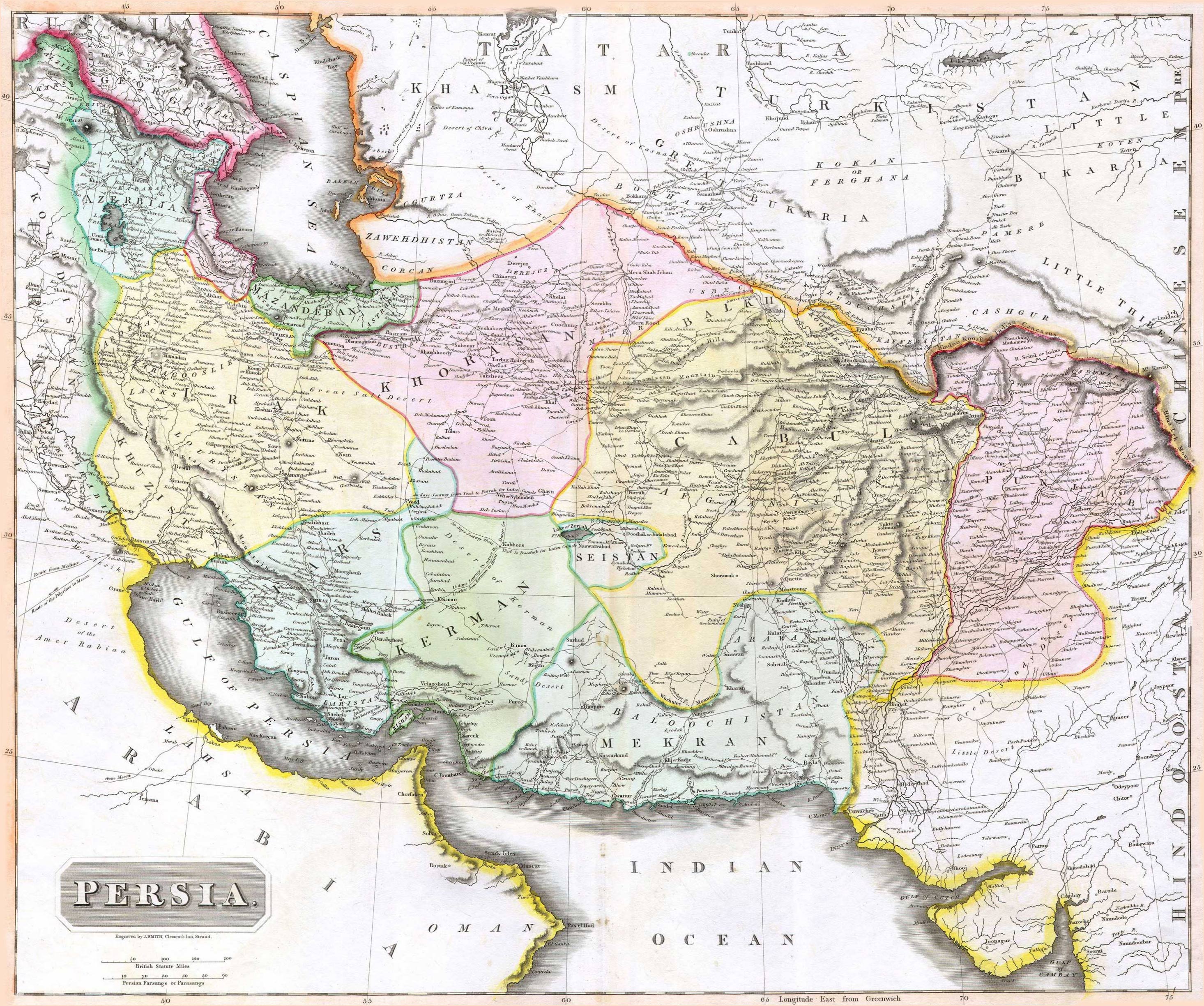
English: 1814 Thomson Map of Persia (Iran), engraved by J. Smith, Clement's Inn, Strand. |
| Tarix | |
| Yaradıcı |
J. Smith, Clement's Inn, Strand. |
| Geotemporal data | |
| Map location | Iran |
| Georeferencing | If inappropriate please set warp_status = skip to hide. |
| Bibliographic data | |
| Nəşr |
New General Atlas (1821) |
| Müəllif |
John Thomson |
| Digər versiyalar | |

Lisenziya
The copyright situation of this work is theoretically uncertain, because in the country of origin copyright lasts 70 years after the death of the author, and the date of the author's death is unknown. However, the date of creation of the work was over 120 years ago, and it is thus a reasonable assumption that the copyright has expired (see here for the community discussion). Do not use this template if the date of death of the author is known.
This work is in the public domain in the United States because it was published (or registered with the U.S. Copyright Office) before January 1, 1929. | |
| This file has been identified as being free of known restrictions under copyright law, including all related and neighboring rights. | |
Faylın tarixçəsi
Faylın əvvəlki versiyasını görmək üçün gün/tarix bölməsindəki tarixlərə klikləyin.
| Tarix/Vaxt | Kiçik şəkil | Ölçülər | İstifadəçi | Şərh | |
|---|---|---|---|---|---|
| indiki | 07:27, 18 avqust 2010 | | 2.931 × 2.448 (1,6 MB) | Begoon | edge perspective and crop |
| 02:35, 19 noyabr 2006 |  | 2.979 × 2.520 (1,45 MB) | Kaveh | == Summary == 1814 Thomson Map of Persia (Iran) Category:Maps of Iran == Licensing == {{PD-old}} |
Fayl keçidləri
Aşağıdakı səhifə bu faylı istifadə edir:
Faylın qlobal istifadəsi
Bu fayl aşağıdakı vikilərdə istifadə olunur:
- ar.wikipedia.org layihəsində istifadəsi
- be.wikipedia.org layihəsində istifadəsi
- bn.wikipedia.org layihəsində istifadəsi
- bs.wikipedia.org layihəsində istifadəsi
- ca.wikipedia.org layihəsində istifadəsi
- da.wikipedia.org layihəsində istifadəsi
- de.wikipedia.org layihəsində istifadəsi
- en.wikipedia.org layihəsində istifadəsi
- es.wikipedia.org layihəsində istifadəsi
- eu.wikipedia.org layihəsində istifadəsi
- fa.wikipedia.org layihəsində istifadəsi
- fr.wikipedia.org layihəsində istifadəsi
- hi.wikipedia.org layihəsində istifadəsi
- hr.wikipedia.org layihəsində istifadəsi
Bu faylın qlobal istifadəsinə baxın.