Fayl:Güven Park and Güven Monument (The Monument of Safety), 1940s (17060228996).jpg
Faylın orijinalı (2.000 × 1.483 piksel, fayl həcmi: 2,14 MB, MIME növü: image/jpeg)
| Bu fayl "Vikimedia Commons"dadır və digər layihələrdə istifadə edilə bilər. |
,_1940s_(17060228996).jpg?uselang=az) |
Faylın təsvir səhifəsinə get |
,_1940s_(17060228996).jpg)
Xülasə
| İzah |
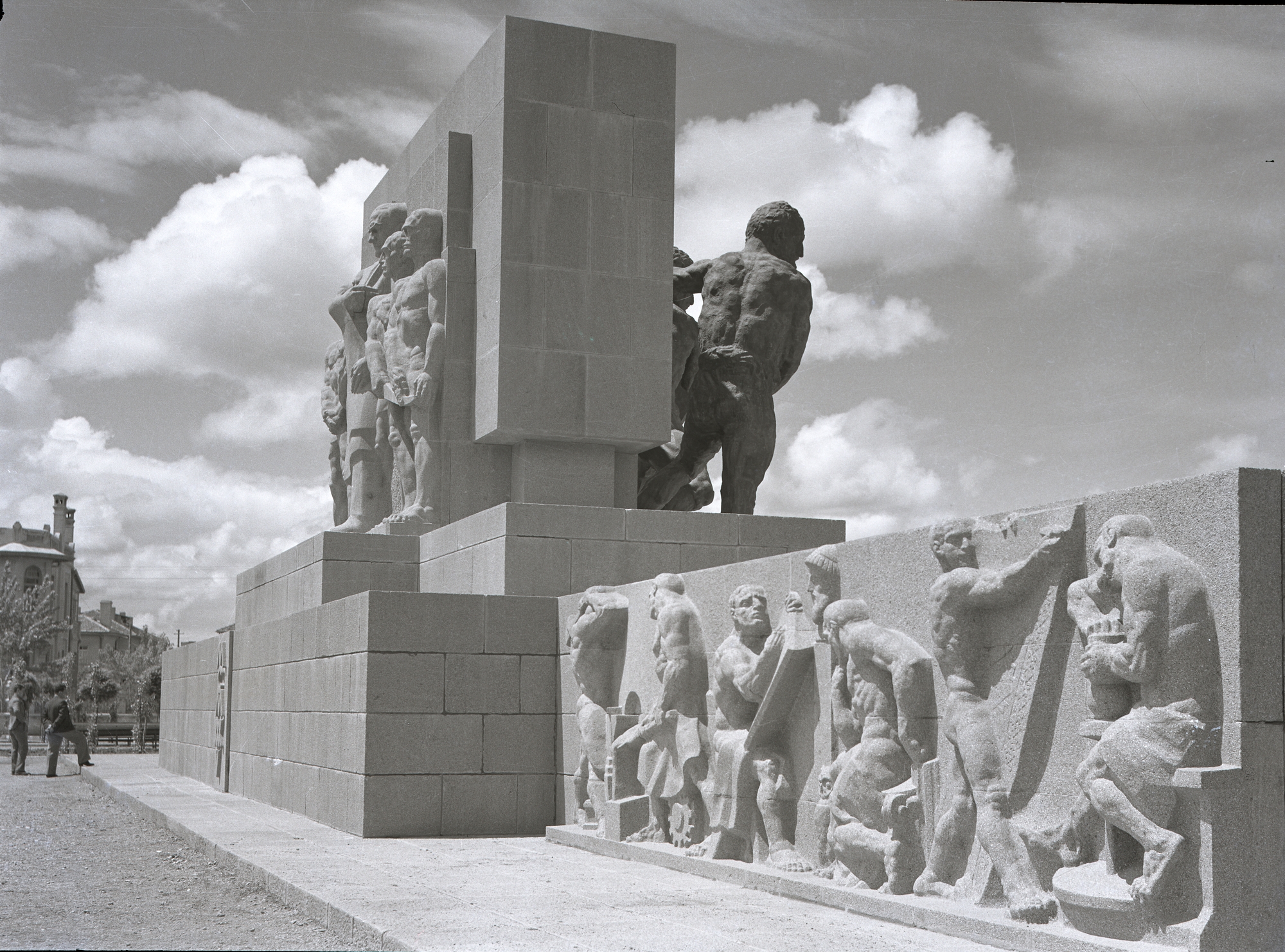
English: In the construction plan of Jansen, a plot which was on the north end of Devlet Mahallesi (State Neighbourhood) and near to the General Directorate of Turkish Red Crescent was allocated as a park. The park built in mid-1930s. The Monument of Safety, as it was called back then, was placed in the middle of it. Sculptor Anton Hanak came to Ankara in 1932 and observed the site allocated for the monument. He visited many quarries and planned the drafts. He wanted to build a monument that would face two sides. The bronze figures which were to be put on the front side (facing the Kızılay Square) were casted in Erdberg Foundry in Vienna. Unfortunately he died in 1934. The construction of the monument was undertaken by another Austrian colleague, Josef Thorak. |
| Tarix | |
| Mənbə | https://www.flickr.com/photos/128445772@N04/17060228996/ |
| Müəllif | Directorate General of Press and Information |
| İcazə (Faylın təkrar istifadəsi) |
At the time of upload, the image license was automatically confirmed using the Flickr API. For more information see Flickr API detail. |
| Flickr sets |
|
| Flickr posted date | 9 aprel 2015 |
Lisenziya
This image was taken from Flickr's The Commons. The uploading organization may have various reasons for determining that no known copyright restrictions exist, such as:
More information can be found at https://flickr.com/commons/usage/. Please add additional copyright tags to this image if more specific information about copyright status can be determined. See Commons:Licensing for more information. |
| This image was originally posted to Flickr by Directorate General of Press and Information at https://www.flickr.com/photos/128445772@N04/17060228996. It was reviewed on 12 iyul 2015 by FlickreviewR and was confirmed to be licensed under the terms of the No known copyright restrictions. |
Faylın tarixçəsi
Faylın əvvəlki versiyasını görmək üçün gün/tarix bölməsindəki tarixlərə klikləyin.
| Tarix/Vaxt | Kiçik şəkil | Ölçülər | İstifadəçi | Şərh | |
|---|---|---|---|---|---|
| indiki | 17:16, 12 iyul 2015 | | 2.000 × 1.483 (2,14 MB) | Fæ | == {{int:filedesc}} == {{subst:chc}} {{information |description={{en|1=In the construction plan of Jansen, a plot which was on the north end of Devlet Mahallesi (State Neighbourhood) and near to the General Directorate of Turkish Red Crescent was alloc... |
Fayl keçidləri
Aşağıdakı səhifə bu faylı istifadə edir:
Faylın qlobal istifadəsi
Bu fayl aşağıdakı vikilərdə istifadə olunur:
- en.wikipedia.org layihəsində istifadəsi
- ru.wikipedia.org layihəsində istifadəsi
- tr.wikipedia.org layihəsində istifadəsi
- www.wikidata.org layihəsində istifadəsi
,_1940s_(17060228996).jpg)