Fayl:Pine Mill Bridge.jpg
Naviqasiyaya keç
Axtarışa keç
Sınaq göstərişi ölçüsü: 758 × 600 piksel. Digər ölçülər: 303 × 240 piksel | 607 × 480 piksel | 971 × 768 piksel | 1.280 × 1.013 piksel | 2.560 × 2.025 piksel | 4.693 × 3.713 piksel.
Faylın orijinalı (4.693 × 3.713 piksel, fayl həcmi: 1,89 MB, MIME növü: image/jpeg)
| Bu fayl "Vikimedia Commons"dadır və digər layihələrdə istifadə edilə bilər. |
 |
Faylın təsvir səhifəsinə get |
| Camera location | | View this and other nearby images on: OpenStreetMap |
|---|
| İzah |
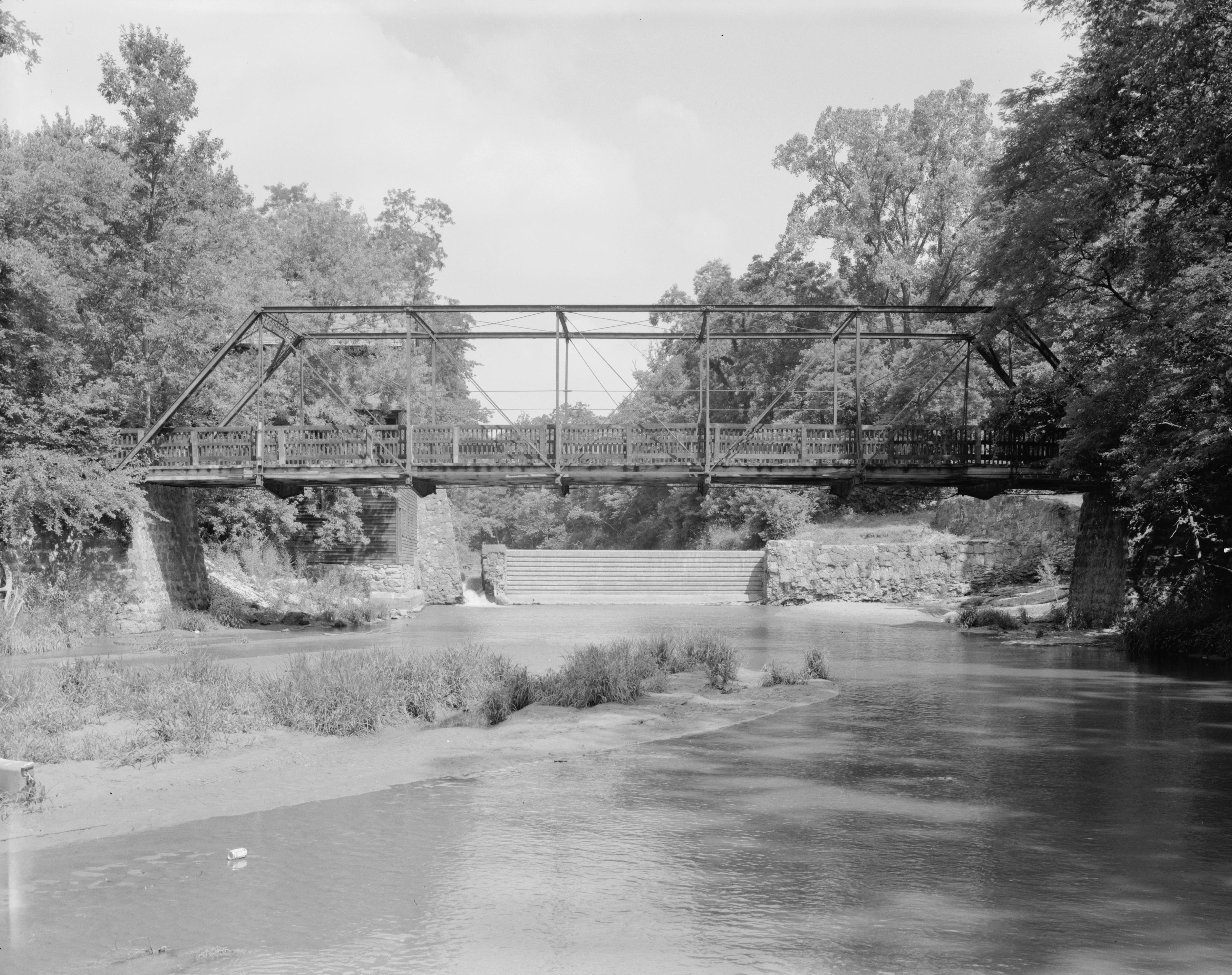
English: Southern (downstream) side of the Pine Mill Bridge, which carries a footpath over Pine Creek in Wildcat Den State Park, just above the Mississippi River above Muscatine in Muscatine County, Iowa, United States. Notice the dam in the background, a remnant of a nearby abandoned mill. Built in 1878, this pinned Pratt through truss bridge is listed on the National Register of Historic Places. |
||||
| Tarix | Summer 1995 | ||||
| Mənbə | Library of Congress, Prints and Photograph Division HAER: IOWA,70-MUSCA.V,2-1 | ||||
| Müəllif | Joseph Elliott | ||||
| İcazə (Faylın təkrar istifadəsi) |
|

|
This image is available from the United States Library of Congress's Prints and Photographs division
under the digital ID hhh.ia0445. This tag does not indicate the copyright status of the attached work. A normal copyright tag is still required. See Commons:Licensing.
|
Faylın tarixçəsi
Faylın əvvəlki versiyasını görmək üçün gün/tarix bölməsindəki tarixlərə klikləyin.
| Tarix/Vaxt | Kiçik şəkil | Ölçülər | İstifadəçi | Şərh | |
|---|---|---|---|---|---|
| indiki | 06:31, 9 oktyabr 2009 | | 4.693 × 3.713 (1,89 MB) | Cropbot | upload cropped version, operated by User:Finavon. Summary: border cropped |
| 02:25, 28 sentyabr 2009 |  | 5.000 × 4.070 (2,19 MB) | Nyttend | {{Location|41|28|3|N|90|52|3|W}} {{Information |Description={{en|Southern (downstream) side of the {{w|Pine Mill Bridge}}, which carries a footpath over Pine Creek in {{w|Wildcat Den State Park}}, just above the {{w|Mississippi River}} above {{w|Muscatine |
Fayl keçidləri
Aşağıdakı səhifə bu faylı istifadə edir:
Faylın qlobal istifadəsi
Bu fayl aşağıdakı vikilərdə istifadə olunur:
- en.wikipedia.org layihəsində istifadəsi