Fayl:Greyfriars, Leicester site.gif
Naviqasiyaya keç
Axtarışa keç

Sınaq göstərişi ölçüsü: 758 × 600 piksel. Digər ölçülər: 303 × 240 piksel | 607 × 480 piksel | 970 × 768 piksel | 1.280 × 1.013 piksel | 1.655 × 1.310 piksel.
Faylın orijinalı (1.655 × 1.310 piksel, fayl həcmi: 651 KB, MIME növü: image/gif)
| Bu fayl "Vikimedia Commons"dadır və digər layihələrdə istifadə edilə bilər. |
 |
Faylın təsvir səhifəsinə get |
Xülasə
| Camera location | | View this and other nearby images on: OpenStreetMap |
|---|
| İzah |
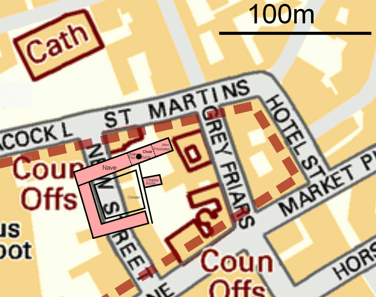
English: Leicester Greyfriars Church site map.
Map is OSGB36 with the Church Choir suggested to be at SK58550438. The dotted brown line indicates the area Billson, 1920, identified as the extent of the Greyfriars grounds. The University of Leicester 2012 dig has posited the Church, Chapter House, Cloisters and monastic buildings as the pink area shown, with a black dot indicating the location of the grave which contained the remains of Richard III. |
| Tarix | |
| Mənbə | Base map OS OpenData VectorMap District. Greyfriars perimeter from Billson, C. J., 1920, Medieval Leicester, facing p. 1. Edgar Backus, Leicester (Archive.org). Greyfriars Church details, University of Leicester Plan of the 2012 Archaeological dig, Mail Online, 12 Sept 2012 |
| Müəllif | RobinLeicester based on sources described. |
Lisenziya
This file is licensed by the Ordnance Survey of the United Kingdom under their OS OpenData License
In short: you are free to distribute and modify the file as long as you attribute (including year), the Ordnance Survey. İstinad: Contains Ordnance Survey data © Crown copyright and database right (year) Note: Derivative works can be licensed under any Creative Commons Attribution 3.0 Licence. |
_(St_Edwards_Crown).svg)
|
This file is licensed under the United Kingdom Open Government Licence v3.0. |
See also: Meta for information on usage on Wikimedia wikis.
|
svg version

|
File:Greyfriars, Leicester site.svg is a vector version of this file. It should be used in place of this GIF file when not inferior.
File:Greyfriars, Leicester site.gif → File:Greyfriars, Leicester site.svg
For more information, see Help:SVG. |
 |
Faylın tarixçəsi
Faylın əvvəlki versiyasını görmək üçün gün/tarix bölməsindəki tarixlərə klikləyin.
| Tarix/Vaxt | Kiçik şəkil | Ölçülər | İstifadəçi | Şərh | |
|---|---|---|---|---|---|
| indiki | 16:27, 5 fevral 2013 | | 1.655 × 1.310 (651 KB) | Soerfm | Dot |
| 23:13, 15 sentyabr 2012 |  | 1.655 × 1.310 (654 KB) | RobinLeicester | User created page with UploadWizard |
Fayl keçidləri
Bu faylı istifadə edən səhifə yoxdur.
Faylın qlobal istifadəsi
Bu fayl aşağıdakı vikilərdə istifadə olunur:
- it.wikipedia.org layihəsində istifadəsi
- no.wikipedia.org layihəsində istifadəsi
- tr.wikipedia.org layihəsində istifadəsi