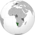
Fayl:German sw africa map.png
Naviqasiyaya keç
Axtarışa keç

Sınaq göstərişi ölçüsü: 600 × 600 piksel. Digər ölçülər: 240 × 240 piksel | 480 × 480 piksel | 768 × 768 piksel | 1.024 × 1.024 piksel | 2.000 × 2.000 piksel.
Faylın orijinalı (2.000 × 2.000 piksel, fayl həcmi: 602 KB, MIME növü: image/png)
Faylın tarixçəsi
Faylın əvvəlki versiyasını görmək üçün gün/tarix bölməsindəki tarixlərə klikləyin.
| Tarix/Vaxt | Kiçik şəkil | Ölçülər | İstifadəçi | Şərh | |
|---|---|---|---|---|---|
| indiki | 15:46, 10 fevral 2023 |  | 2.000 × 2.000 (602 KB) | Goran tek-en | Added border of South Sudan as requested by Maphobbyist |
| 15:30, 6 aprel 2013 |  | 2.000 × 2.000 (596 KB) | OgreBot | (BOT): Reverting to most recent version before archival | |
| 15:30, 6 aprel 2013 |  | 2.000 × 2.000 (596 KB) | OgreBot | (BOT): Uploading old version of file from en.wikipedia; originally uploaded on 2010-06-02 20:50:38 by VoodooIsland | |
| 15:30, 6 aprel 2013 |  | 2.000 × 2.000 (595 KB) | OgreBot | (BOT): Uploading old version of file from en.wikipedia; originally uploaded on 2010-06-02 20:49:01 by VoodooIsland | |
| 11:14, 5 aprel 2013 |  | 2.000 × 2.000 (596 KB) | File Upload Bot (Magnus Manske) | Transfered from en.wikipedia by User:misha motsniy using CommonsHelper |
Fayl keçidləri
Aşağıdakı səhifə bu faylı istifadə edir:
Faylın qlobal istifadəsi
Bu fayl aşağıdakı vikilərdə istifadə olunur:
- af.wikipedia.org layihəsində istifadəsi
- ar.wikipedia.org layihəsində istifadəsi
- ast.wikipedia.org layihəsində istifadəsi
- be.wikipedia.org layihəsində istifadəsi
- cs.wikipedia.org layihəsində istifadəsi
- el.wikipedia.org layihəsində istifadəsi
- he.wikipedia.org layihəsində istifadəsi
- hi.wikipedia.org layihəsində istifadəsi
- it.wikipedia.org layihəsində istifadəsi
- li.wikipedia.org layihəsində istifadəsi
- lt.wikipedia.org layihəsində istifadəsi
- mr.wikipedia.org layihəsində istifadəsi
- nl.wikipedia.org layihəsində istifadəsi
- simple.wikipedia.org layihəsində istifadəsi
- uk.wikipedia.org layihəsində istifadəsi
- ur.wikipedia.org layihəsində istifadəsi
- vi.wikipedia.org layihəsində istifadəsi
- www.wikidata.org layihəsində istifadəsi
