Fayl:Water Level Route on US map.png
Naviqasiyaya keç
Axtarışa keç

Sınaq göstərişi ölçüsü: 800 × 542 piksel. Digər ölçülər: 320 × 217 piksel | 640 × 433 piksel | 1.024 × 693 piksel | 1.280 × 867 piksel | 2.560 × 1.733 piksel | 5.912 × 4.003 piksel.
Faylın orijinalı (5.912 × 4.003 piksel, fayl həcmi: 1,88 MB, MIME növü: image/png)
| Bu fayl "Vikimedia Commons"dadır və digər layihələrdə istifadə edilə bilər. |
 |
Faylın təsvir səhifəsinə get |
Xülasə
| İzah |
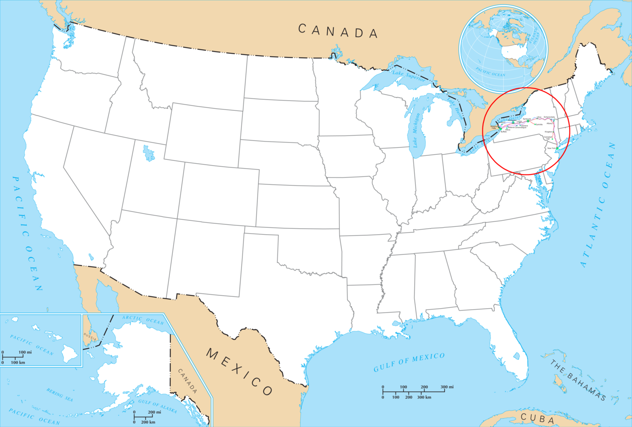
English: Water Level Routes of the New York Central Railroad, West Shore Railroad and Erie Canal on Image:US state outline map.png. See Image:Water Level Route on US map cropped.png for a cropped one. |
| Tarix | |
| Mənbə | Öz işi |
| Müəllif | SPUI |
| Digər versiyalar | Image:Water Level Route on US map cropped.png - uncropped version. |
Lisenziya
| This work has been released into the public domain by its author, SPUI. This applies worldwide. In some countries this may not be legally possible; if so: |
Faylın tarixçəsi
Faylın əvvəlki versiyasını görmək üçün gün/tarix bölməsindəki tarixlərə klikləyin.
| Tarix/Vaxt | Kiçik şəkil | Ölçülər | İstifadəçi | Şərh | |
|---|---|---|---|---|---|
| indiki | 19:43, 3 iyul 2005 | | 5.912 × 4.003 (1,88 MB) | SPUI~commonswiki | {{spuimap}} Water Level Routes of the New York Central Railroad, West Shore Railroad and Erie Canal on Image:US state outline map.png. See Image:Water Level Route on US map cropped.png for a cropped one. category:New York Central Railroad |
Fayl keçidləri
Bu faylı istifadə edən səhifə yoxdur.