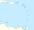
Fayl:Lesser Antilles location map.svg
Naviqasiyaya keç
Axtarışa keç

Bu SVG-faylın PNG formatındakı bu görünüşünün ölçüsü: 698 × 599 piksel. Digər ölçülər: 280 × 240 piksel | 559 × 480 piksel | 894 × 768 piksel | 1.192 × 1.024 piksel | 2.385 × 2.048 piksel | 1.346 × 1.156 piksel.
Faylın orijinalı (SVG faylı, nominal olaraq 1.346 × 1.156 piksel, faylın ölçüsü: 184 KB)
Faylın tarixçəsi
Faylın əvvəlki versiyasını görmək üçün gün/tarix bölməsindəki tarixlərə klikləyin.
| Tarix/Vaxt | Miniatür | Ölçülər | İstifadəçi | Şərh | |
|---|---|---|---|---|---|
| hal-hazırkı | 13:59, 24 sentyabr 2018 |  | 1.346 × 1.156 (184 KB) | NordNordWest | Reverted to version as of 14:01, 13 October 2010 (UTC); please don't change the size of the map, some templates need the correct size |
| 12:00, 24 sentyabr 2018 |  | 512 × 439 (114 KB) | Splintax | Nations grouped together and labelled with DOM IDs and inline styles replaced with semantic CSS classes. This reduces the file size and allows the SVG to be animated with JavaScript (eg. to selectively add labels, or change the style of a particular country to highlight it). | |
| 14:01, 13 oktyabr 2010 |  | 1.346 × 1.156 (184 KB) | NordNordWest | upd | |
| 15:56, 29 sentyabr 2009 |  | 1.346 × 1.156 (281 KB) | NordNordWest | =={{int:filedesc}}== {{Information |Description= {{de|Positionskarte der Kleinen Antillen}} Quadratische Plattkarte, N-S-Streckung 103 %. Geographische Begrenzung der Karte: * N: 19.2° N * S: 9.7° N * W: 70.5° W * O: 59.1° W {{ |
Faylın istifadəsi
Aşağıdakı 2 səhifə bu faylı istifadə edir:
Faylın qlobal istifadəsi
Bu fayl aşağıdakı vikilərdə istifadə olunur:
- af.wikipedia.org layihəsində istifadəsi
- als.wikipedia.org layihəsində istifadəsi
- ar.wikipedia.org layihəsində istifadəsi
- ba.wikipedia.org layihəsində istifadəsi
- be.wikipedia.org layihəsində istifadəsi
- bs.wikipedia.org layihəsində istifadəsi
- ceb.wikipedia.org layihəsində istifadəsi
- ckb.wikipedia.org layihəsində istifadəsi
- cs.wikipedia.org layihəsində istifadəsi
- da.wikipedia.org layihəsində istifadəsi
- de.wikipedia.org layihəsində istifadəsi
- Liste der Nationalparks im Königreich der Niederlande
- Oranjestad (Sint Eustatius)
- Benutzer:Spischot/Sketchpad 3
- Cricket World Cup 2007
- Flamingo International Airport
- Kralendijk
- Vorlage:Positionskarte Aruba
- Wikipedia:Kartenwerkstatt/Positionskarten/Nordamerika
- Juancho E. Yrausquin Airport
- West Indies Cricket Team
- Vorlage:Positionskarte Niederländische Antillen (ABC-Inseln)
- Vorlage:Positionskarte Niederländische Antillen (Inseln über dem Winde)
- Vorlage:Positionskarte Kleine Antillen
- ICC World Twenty20 2010
- ICC Women’s World Twenty20 2010
- Vorlage:Positionskarte Curaçao
- Vorlage:Positionskarte Sint Maarten
- Vorlage:Positionskarte Aruba 2
- Caribbean Premier League 2013
Bu faylın qlobal istifadəsinə baxın.
